Ignacio Ramírez geodata
Ignacio Ramírez (Durango) is a populated place; located in Mexico in America/Monterrey (GMT-6) time zone. With population of 2,432 people, there are 3626 cities with bigger population in this country. Compared to other cities in Mexico, 90.9% of cities are located further ↓South; 90.2% of cities are located further →East and 75.4% of cities have lower elevation than Ignacio Ramírez. Note1


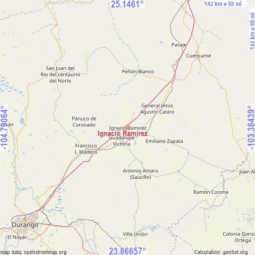
Ignacio Ramírez GPS coordinates[2]
24° 30' 28.656" North, 104° 5' 15.036" West
| Map corner | latitude | longitude |
|---|---|---|
| Upper-left | 25.1461°, | -104.79064° |
| Center: | 24.50796°, | -104.08751° |
| Lower-right: | 23.86657°, | -103.38439° |
| Map W x H: | 142.3×142.3 km | = 88.4×88.4mi |
| max Lat: | 32.7° ⇑9.1% North |
| Ignacio Ramírez: | 24.50796° |
| min Lat: | ⇓90.9% South 14.53588° |
| min Long | Ignacio Ramíre | max Long |
| -117.105° | -104.08751° | -86.73105° |
| W 9.8%⇐ | ⇒90.2% E |
Elevation
Elevation of Ignacio Ramírez is 2038 m = 6686 ft, and this is 784.3 m = 2573 ft above average elevation for this country.
| Max E: |
3497 m = 11473 ft | 24.6% |
| Ignacio Ramírez | 2038 m 6686 ft | |
| Avg. | 1253.7 m = 4113 ft | |
Min E: |
-1 m = -3 ft | 75.4% |
See also: Mexico elevation on elevation.city.
Geographical zone
Ignacio Ramírez is located in North temperate zone (between Tropic of Cancer and the Arctic Circle). Distance of this Northern Tropic circle is 119.1 km =74 mi to South.| Distance of | km | miles | from Ignacio Ramírez |
|---|---|---|---|
| North Pole | 7282 | 4524.8 | to North |
| Arctic Circle | 4676.1 | 2905.6 | to North |
| Tropic Cancer | 119.1 | 74 | to South |
| Equator | 2725 | 1693.2 | to South |


Nearby cities:
15 places around Ignacio Ramírez: (largest is in red/bold)
• Antonio Amaro
26.6 km =16.5 mi,  164°
164°
• Ciudad Guadalupe Victoria
7.9 km =4.9 mi,  205°
205°
• Emiliano Zapata
21.5 km =13.4 mi,  109°
109°
• Felipe Carrillo Puerto
20.9 km =13 mi, 158°
• Francisco I. Madero
26.4 km =16.4 mi,  243°
243°
• General Calixto Contreras
9.7 km =6 mi,  154°
154°
• General Ignacio Zaragoza
24.8 km =15.4 mi,  264°
264°
• Ignacio Allende
9.9 km =6.2 mi, 112°
• José Guadalupe Rodríguez
21 km =13 mi,  177°
177°
• José María Pino Suárez (Providencia)
13.4 km =8.3 mi,  172°
172°
• Juan Aldama
7.6 km =4.7 mi,  233°
233°
• Luis Moya
13.3 km =8.3 mi,  69°
69°
• Pánuco de Coronado
24.5 km =15.2 mi,  278°
278°
• San José Avino
21.5 km =13.4 mi,  274°
274°
• Santa Catalina de Siena
9.2 km =5.7 mi,  323°
323°
Sources, notices
• [Note1] Compared only with cities in Mexico existing in our database
• [Src1] Map data: © OpenStreetMap contributors (CC-BY-SA)
• [Src2] Other city data from geonames.org with taken over terms of usage.
• [Src3] Geographical zone / Annual Mean Temperature by Robert A. Rohde @ Wikipedia
