Puebla geodata
Puebla (Baja California) is a populated place; located in Mexico in America/Tijuana (GMT-7) time zone. With population of 15,168 people, there are 634 cities with bigger population in this country. Compared to other cities in Mexico, 99.9% of cities are located further ↓South; 99.4% of cities are located further →East and 98.7% of cities have higher elevation than Puebla. Note1


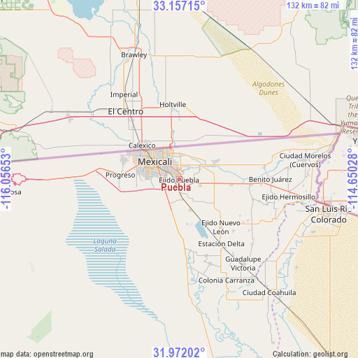
Puebla GPS coordinates[2]
32° 33' 59.544" North, 115° 21' 12.24" West
| Map corner | latitude | longitude |
|---|---|---|
| Upper-left | 33.15715°, | -116.05653° |
| Center: | 32.56654°, | -115.3534° |
| Lower-right: | 31.97202°, | -114.65028° |
| Map W x H: | 131.8×131.8 km | = 81.9×81.9mi |
| max Lat: | 32.7° ⇑0.1% North |
| Puebla: | 32.56654° |
| min Lat: | ⇓99.9% South 14.53588° |
| min Long | Puebla | max Long |
| -117.105° | -115.3534° | -86.73105° |
| W 0.6%⇐ | ⇒99.4% E |
Elevation
Elevation of Puebla is 7 m = 23 ft, and this is 1246.7 m = 4090 ft below average elevation for this country.
| Max E: |
3497 m = 11473 ft | 98.7% |
| Avg. | 1253.7 m = 4113 ft | |
| Puebla | 7 m = 23 ft | |
Min E: |
-1 m = -3 ft | 1.3% |
See also: Mexico elevation on elevation.city.
Geographical zone
Puebla is located in North temperate zone (between Tropic of Cancer and the Arctic Circle). Distance of this Northern Tropic circle is 1015.1 km =630.8 mi to South.| Distance of | km | miles | from Puebla |
|---|---|---|---|
| North Pole | 6386 | 3968.1 | to North |
| Arctic Circle | 3780.1 | 2348.8 | to North |
| Tropic Cancer | 1015.1 | 630.8 | to South |
| Equator | 3621.1 | 2250 | to South |


Nearby cities:
15 places around Puebla: (largest is in red/bold)
• Colonia Pólvora
15.3 km =9.5 mi,  96°
96°
• Ejido Chihuahua
13.9 km =8.6 mi,  129°
129°
• Ejido Jalapa
18.3 km =11.4 mi, 127°
• Ejido Michoacán de Ocampo
12 km =7.5 mi,  160°
160°
• Ejido Sinaloa
8.1 km =5 mi,  105°
105°
• Ejido Tamaulipas
11.6 km =7.2 mi, 99°
• Ejido el Choropo (Colonia Colorado Número Uno)
7.2 km =4.5 mi,  233°
233°
• Guanajuato
5.5 km =3.4 mi,  165°
165°
• Islas Agrarias Grupo A
5.3 km =3.3 mi,  22°
22°
• Islas Agrarias Grupo B
8.5 km =5.3 mi,  63°
63°
• Jesús Sansón Flores
13.9 km =8.6 mi,  187°
187°
• Lomas de Abasolo
6.2 km =3.9 mi,  350°
350°
• Mexicali
11.7 km =7.3 mi,  305°
305°
• Reacomodo Río Colorado
16.7 km =10.4 mi,  283°
283°
• Zaragoza
17.3 km =10.7 mi, 283°
Sources, notices
• [Note1] Compared only with cities in Mexico existing in our database
• [Src1] Map data: © OpenStreetMap contributors (CC-BY-SA)
• [Src2] Other city data from geonames.org with taken over terms of usage.
• [Src3] Geographical zone / Annual Mean Temperature by Robert A. Rohde @ Wikipedia
