Congregación Ortíz geodata
Congregación Ortíz (Chihuahua) is a populated place; located in Mexico in America/Chihuahua (GMT-6) time zone. With population of 2,620 people, there are 3384 cities with bigger population in this country. Compared to other cities in Mexico, 97.5% of cities are located further ↓South; 93.3% of cities are located further →East and 56.2% of cities have higher elevation than Congregación Ortíz. Note1


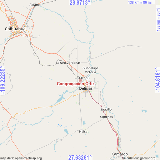
Congregación Ortíz GPS coordinates[2]
28° 15' 13.5" North, 105° 31' 9.192" West
| Map corner | latitude | longitude |
|---|---|---|
| Upper-left | 28.8713°, | -106.22235° |
| Center: | 28.25375°, | -105.51922° |
| Lower-right: | 27.63261°, | -104.8161° |
| Map W x H: | 137.7×137.7 km | = 85.6×85.6mi |
| max Lat: | 32.7° ⇑2.5% North |
| Congregación Ortíz: | 28.25375° |
| min Lat: | ⇓97.5% South 14.53588° |
| min Long | Congregación O | max Long |
| -117.105° | -105.51922° | -86.73105° |
| W 6.7%⇐ | ⇒93.3% E |
Elevation
Elevation of Congregación Ortíz is 1150 m = 3773 ft, and this is 103.7 m = 340 ft below average elevation for this country.
| Max E: |
3497 m = 11473 ft | 56.2% |
| Avg. | 1253.7 m = 4113 ft | |
| Congregación Ortíz | 1150 m = 3773 ft | |
Min E: |
-1 m = -3 ft | 43.8% |
See also: Mexico elevation on elevation.city.
Geographical zone
Congregación Ortíz is located in North temperate zone (between Tropic of Cancer and the Arctic Circle). Distance of this Northern Tropic circle is 535.6 km =332.8 mi to South.| Distance of | km | miles | from Congregación Ortíz |
|---|---|---|---|
| North Pole | 6865.5 | 4266 | to North |
| Arctic Circle | 4259.7 | 2646.9 | to North |
| Tropic Cancer | 535.6 | 332.8 | to South |
| Equator | 3141.5 | 1952 | to South |


Nearby cities:
15 places around Congregación Ortíz: (largest is in red/bold)
• Ciudad Delicias
8.6 km =5.3 mi,  145°
145°
• Colonia Abraham González (La Quemada)
12.1 km =7.5 mi,  115°
115°
• Colonia Campesina
12.6 km =7.8 mi,  183°
183°
• Colonia Revolución
7.5 km =4.7 mi,  100°
100°
• Colonia Terrazas
5.6 km =3.5 mi,  108°
108°
• Colonia Vicente Guerrero
10.8 km =6.7 mi,  125°
125°
• El Molino
9.9 km =6.2 mi,  190°
190°
• El Torreón
13.1 km =8.1 mi,  52°
52°
• Estación Consuelo
11.3 km =7 mi,  319°
319°
• Ex-Hacienda Delicias
7.6 km =4.7 mi, 187°
• Guadalupe Victoria
12.6 km =7.8 mi, 45°
• La Garita
13.5 km =8.4 mi,  206°
206°
• Las Puentes
8.5 km =5.3 mi,  55°
55°
• Meoqui
4.3 km =2.7 mi, 61°
• Rosales
8.2 km =5.1 mi, 206°
Sources, notices
• [Note1] Compared only with cities in Mexico existing in our database
• [Src1] Map data: © OpenStreetMap contributors (CC-BY-SA)
• [Src2] Other city data from geonames.org with taken over terms of usage.
• [Src3] Geographical zone / Annual Mean Temperature by Robert A. Rohde @ Wikipedia
