Las Delicias geodata
Las Delicias (Baja California) is a populated place; located in Mexico in America/Tijuana (GMT-7) time zone. With population of 15,486 people, there are 618 cities with bigger population in this country. Compared to other cities in Mexico, 99.5% of cities are located further ↓South; 99.9% of cities are located further →East and 73.4% of cities have higher elevation than Las Delicias. Note1


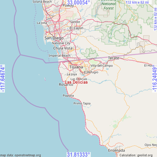
Las Delicias GPS coordinates[2]
32° 24' 32.004" North, 116° 56' 36.996" West
| Map corner | latitude | longitude |
|---|---|---|
| Upper-left | 33.00054°, | -117.64674° |
| Center: | 32.40889°, | -116.94361° |
| Lower-right: | 31.81333°, | -116.24049° |
| Map W x H: | 132×132 km | = 82×82mi |
| max Lat: | 32.7° ⇑0.5% North |
| Las Delicias: | 32.40889° |
| min Lat: | ⇓99.5% South 14.53588° |
| min Long | Las Delicias | max Long |
| -117.105° | -116.94361° | -86.73105° |
| W 0.1%⇐ | ⇒99.9% E |
Elevation
Elevation of Las Delicias is 277 m = 909 ft, and this is 976.7 m = 3204 ft below average elevation for this country.
| Max E: |
3497 m = 11473 ft | 73.4% |
| Avg. | 1253.7 m = 4113 ft | |
| Las Delicias | 277 m = 909 ft | |
Min E: |
-1 m = -3 ft | 26.6% |
See also: Mexico elevation on elevation.city.
Geographical zone
Las Delicias is located in North temperate zone (between Tropic of Cancer and the Arctic Circle). Distance of this Northern Tropic circle is 997.6 km =619.9 mi to South.| Distance of | km | miles | from Las Delicias |
|---|---|---|---|
| North Pole | 6403.5 | 3978.9 | to North |
| Arctic Circle | 3797.6 | 2359.7 | to North |
| Tropic Cancer | 997.6 | 619.9 | to South |
| Equator | 3603.5 | 2239.1 | to South |


Nearby cities:
15 places around Las Delicias: (largest is in red/bold)
• Ampliación Ejido Lázaro Cárdenas
4.6 km =2.9 mi,  295°
295°
• Buenos Aires
1.6 km =1 mi,  8°
8°
• Ciudad Morelos
9.6 km =6 mi,  221°
221°
• Colinas del Sol
8.2 km =5.1 mi,  265°
265°
• Fuentes del Sol
9.1 km =5.7 mi,  284°
284°
• Genaro Vázquez Sección Tres
4.4 km =2.7 mi,  317°
317°
• Isla Cedros
9.8 km =6.1 mi,  285°
285°
• Isla Cozumel
9.8 km =6.1 mi, 287°
• Los Alcatraces
6.4 km =4 mi, 283°
• Los Valles
2.1 km =1.3 mi,  210°
210°
• Pórticos de San Antonio
9.3 km =5.8 mi, 293°
• Rancho La Gloria
6.8 km =4.2 mi,  307°
307°
• San Luis
2.7 km =1.7 mi,  339°
339°
• Valle Bonito
6 km =3.7 mi,  71°
71°
• Villa del Prado 2da Sección
3.1 km =1.9 mi, 302°
Sources, notices
• [Note1] Compared only with cities in Mexico existing in our database
• [Src1] Map data: © OpenStreetMap contributors (CC-BY-SA)
• [Src2] Other city data from geonames.org with taken over terms of usage.
• [Src3] Geographical zone / Annual Mean Temperature by Robert A. Rohde @ Wikipedia
