El Palacio geodata
El Palacio (State of Mexico) is a populated place; located in Mexico in America/Mexico_City (GMT-6) time zone. With population of 1,268 people, there are 6830 cities with bigger population in this country. Compared to other cities in Mexico, 57.6% of cities are located further ↑North; 55% of cities are located further →East and 97.7% of cities have lower elevation than El Palacio. Note1


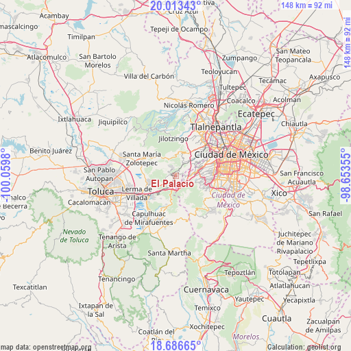
El Palacio GPS coordinates[2]
19° 21' 5.004" North, 99° 21' 24.012" West
| Map corner | latitude | longitude |
|---|---|---|
| Upper-left | 20.01343°, | -100.0598° |
| Center: | 19.35139°, | -99.35667° |
| Lower-right: | 18.68665°, | -98.65355° |
| Map W x H: | 147.5×147.5 km | = 91.7×91.7mi |
| max Lat: | 32.7° ⇑57.6% North |
| El Palacio: | 19.35139° |
| min Lat: | ⇓42.4% South 14.53588° |
| min Long | El Palacio | max Long |
| -117.105° | -99.35667° | -86.73105° |
| W 45%⇐ | ⇒55% E |
Elevation
Elevation of El Palacio is 2728 m = 8950 ft, and this is 1474.3 m = 4837 ft above average elevation for this country.
| Max E: |
3497 m = 11473 ft | 2.3% |
| El Palacio | 2728 m 8950 ft | |
| Avg. | 1253.7 m = 4113 ft | |
Min E: |
-1 m = -3 ft | 97.7% |
See also: Mexico elevation on elevation.city.
Geographical zone
El Palacio is located in North Torrid zone (between Equator and Tropic of Cancer). Distance of this Northern Tropic circle is 454.2 km =282.2 mi to North.| Distance of | km | miles | from El Palacio |
|---|---|---|---|
| North Pole | 7855.4 | 4881.1 | to North |
| Arctic Circle | 5249.5 | 3261.9 | to North |
| Tropic Cancer | 454.2 | 282.2 | to North |
| Equator | 2151.7 | 1337 | to South |


Nearby cities:
15 places around El Palacio: (largest is in red/bold)
• Barrio de Canales
3.1 km =1.9 mi,  320°
320°
• Barrio de San Ramón
3.6 km =2.2 mi,  47°
47°
• Cerro de San Francisco
2.2 km =1.4 mi,  14°
14°
• Dos Ríos
2.9 km =1.8 mi,  27°
27°
• El Cerrito
1 km =0.6 mi,  63°
63°
• El Laurel
1.1 km =0.7 mi,  295°
295°
• El Mirasol
2.6 km =1.6 mi,  93°
93°
• Huixquilucan
1.2 km =0.7 mi,  35°
35°
• Huixquilucan de Degollado
1.2 km =0.7 mi, 36°
• Ignacio Allende
0.9 km =0.6 mi,  212°
212°
• Paraje la Pera
3.5 km =2.2 mi,  20°
20°
• Piedra Grande
3.3 km =2.1 mi,  268°
268°
• San Francisco Ayotuzco
1.6 km =1 mi,  358°
358°
• San Juan Yautepec
1.7 km =1.1 mi,  99°
99°
• Zacamulpa
2.7 km =1.7 mi,  79°
79°
Sources, notices
• [Note1] Compared only with cities in Mexico existing in our database
• [Src1] Map data: © OpenStreetMap contributors (CC-BY-SA)
• [Src2] Other city data from geonames.org with taken over terms of usage.
• [Src3] Geographical zone / Annual Mean Temperature by Robert A. Rohde @ Wikipedia
