Paso de Pirules geodata
Paso de Pirules (Guanajuato) is a populated place; located in Mexico in America/Mexico_City (GMT-6) time zone. With population of 1,189 people, there are 7304 cities with bigger population in this country. Compared to other cities in Mexico, 75.7% of cities are located further ↓South; 75.7% of cities are located further →East and 67.4% of cities have lower elevation than Paso de Pirules. Note1


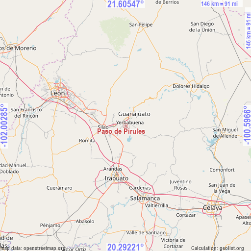
Paso de Pirules GPS coordinates[2]
20° 57' 1.008" North, 101° 17' 58.992" West
| Map corner | latitude | longitude |
|---|---|---|
| Upper-left | 21.60547°, | -102.00285° |
| Center: | 20.95028°, | -101.29972° |
| Lower-right: | 20.29221°, | -100.5966° |
| Map W x H: | 146×146 km | = 90.7×90.7mi |
| max Lat: | 32.7° ⇑24.3% North |
| Paso de Pirules: | 20.95028° |
| min Lat: | ⇓75.7% South 14.53588° |
| min Long | Paso de Pirules | max Long |
| -117.105° | -101.29972° | -86.73105° |
| W 24.3%⇐ | ⇒75.7% E |
Elevation
Elevation of Paso de Pirules is 1876 m = 6155 ft, and this is 622.3 m = 2042 ft above average elevation for this country.
| Max E: |
3497 m = 11473 ft | 32.6% |
| Paso de Pirules | 1876 m 6155 ft | |
| Avg. | 1253.7 m = 4113 ft | |
Min E: |
-1 m = -3 ft | 67.4% |
See also: Mexico elevation on elevation.city.
Geographical zone
Paso de Pirules is located in North Torrid zone (between Equator and Tropic of Cancer). Distance of this Northern Tropic circle is 276.5 km =171.8 mi to North.| Distance of | km | miles | from Paso de Pirules |
|---|---|---|---|
| North Pole | 7677.6 | 4770.6 | to North |
| Arctic Circle | 5071.7 | 3151.4 | to North |
| Tropic Cancer | 276.5 | 171.8 | to North |
| Equator | 2329.5 | 1447.5 | to South |


Nearby cities:
15 places around Paso de Pirules: (largest is in red/bold)
• Cañada de Bustos
5.3 km =3.3 mi,  194°
194°
• Cuevas
2.7 km =1.7 mi,  163°
163°
• El Maluco
1.9 km =1.2 mi,  144°
144°
• Fraccionamiento Arboledas
2.2 km =1.4 mi,  75°
75°
• Fraccionamiento Villas de Guanajuato
1.1 km =0.7 mi,  8°
8°
• La Presita
3.5 km =2.2 mi,  130°
130°
• Marfil
4.9 km =3 mi,  19°
19°
• Puentecillas
3 km =1.9 mi, 133°
• San Isidro
3.1 km =1.9 mi, 84°
• San José de Cervera
2 km =1.2 mi,  351°
351°
• San José de Tránsito
3.9 km =2.4 mi,  237°
237°
• San Marcos
4.9 km =3 mi,  252°
252°
• Santa Catarina de Cuevas (El Tinaco)
1.4 km =0.9 mi,  172°
172°
• Santa Teresa
2 km =1.2 mi,  301°
301°
• Yerbabuena
3 km =1.9 mi,  61°
61°
Sources, notices
• [Note1] Compared only with cities in Mexico existing in our database
• [Src1] Map data: © OpenStreetMap contributors (CC-BY-SA)
• [Src2] Other city data from geonames.org with taken over terms of usage.
• [Src3] Geographical zone / Annual Mean Temperature by Robert A. Rohde @ Wikipedia
