Dangú geodata
Dangú (State of Mexico) is a populated place; located in Mexico in America/Mexico_City (GMT-6) time zone. With population of 748 people, there are 11708 cities with bigger population in this country. Compared to other cities in Mexico, 53.7% of cities are located further ↑North; 55.6% of cities are located further →East and 99.3% of cities have lower elevation than Dangú. Note1


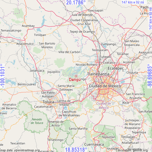
Dangú GPS coordinates[2]
19° 31' 2.1" North, 99° 23' 59.892" West
| Map corner | latitude | longitude |
|---|---|---|
| Upper-left | 20.1786°, | -100.1031° |
| Center: | 19.51725°, | -99.39997° |
| Lower-right: | 18.85318°, | -98.69685° |
| Map W x H: | 147.4×147.4 km | = 91.6×91.6mi |
| max Lat: | 32.7° ⇑53.7% North |
| Dangú: | 19.51725° |
| min Lat: | ⇓46.3% South 14.53588° |
| min Long | Dangú | max Long |
| -117.105° | -99.39997° | -86.73105° |
| W 44.4%⇐ | ⇒55.6% E |
Elevation
Elevation of Dangú is 2880 m = 9449 ft, and this is 1626.3 m = 5336 ft above average elevation for this country.
| Max E: |
3497 m = 11473 ft | 0.7% |
| Dangú | 2880 m 9449 ft | |
| Avg. | 1253.7 m = 4113 ft | |
Min E: |
-1 m = -3 ft | 99.3% |
See also: Mexico elevation on elevation.city.
Geographical zone
Dangú is located in North Torrid zone (between Equator and Tropic of Cancer). Distance of this Northern Tropic circle is 435.8 km =270.8 mi to North.| Distance of | km | miles | from Dangú |
|---|---|---|---|
| North Pole | 7836.9 | 4869.6 | to North |
| Arctic Circle | 5231.1 | 3250.5 | to North |
| Tropic Cancer | 435.8 | 270.8 | to North |
| Equator | 2170.1 | 1348.4 | to South |


Nearby cities:
15 places around Dangú: (largest is in red/bold)
• Barrio de Ensido
3.7 km =2.3 mi,  134°
134°
• Barrio de Rancho Viejo
6.9 km =4.3 mi,  118°
118°
• Barrio la Cuesta
7.1 km =4.4 mi,  110°
110°
• Cañada de Onofres
7.5 km =4.7 mi,  46°
46°
• Colonia Aurora
4.9 km =3 mi,  323°
323°
• Colonia Palma
5.8 km =3.6 mi,  334°
334°
• Ejido Miraflores
5.9 km =3.7 mi,  2°
2°
• Ejido Palma (Ejido San Francisco)
5.8 km =3.6 mi,  350°
350°
• San Luis Ayucán
4.5 km =2.8 mi, 121°
• San Miguel Tecpan
1.7 km =1.1 mi,  7°
7°
• Santa Ana Jilotzingo
2.7 km =1.7 mi, 11°
• Santa María Mazatla
1.4 km =0.9 mi,  99°
99°
• Santiago Tepatlaxco
7.5 km =4.7 mi, 128°
• Tlazala de Fabela
4.8 km =3 mi,  341°
341°
• Transfiguración
7 km =4.3 mi, 342°
Sources, notices
• [Note1] Compared only with cities in Mexico existing in our database
• [Src1] Map data: © OpenStreetMap contributors (CC-BY-SA)
• [Src2] Other city data from geonames.org with taken over terms of usage.
• [Src3] Geographical zone / Annual Mean Temperature by Robert A. Rohde @ Wikipedia
