Ruiz Cortines Número Uno geodata
Ruiz Cortines Número Uno (Sinaloa) is a populated place; located in Mexico in America/Mazatlan (GMT-7) time zone. With population of 577 people, there are 14851 cities with bigger population in this country. Compared to other cities in Mexico, 93.9% of cities are located further ↓South; 96.6% of cities are located further →East and 89.4% of cities have higher elevation than Ruiz Cortines Número Uno. Note1
Current local time in Ruiz Cortines Número Uno:
07:32 AM, WednesdayDifference from your time zone: hours


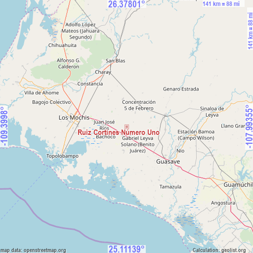
Ruiz Cortines Número Uno GPS coordinates[2]
25° 44' 47.004" North, 108° 41' 48.012" West
| Map corner | latitude | longitude |
|---|---|---|
| Upper-left | 26.37801°, | -109.3998° |
| Center: | 25.74639°, | -108.69667° |
| Lower-right: | 25.11139°, | -107.99355° |
| Map W x H: | 140.8×140.8 km | = 87.5×87.5mi |
| max Lat: | 32.7° ⇑6.1% North |
| Ruiz Cortines Número Uno: | 25.74639° |
| min Lat: | ⇓93.9% South 14.53588° |
| min Long | Ruiz Cortines N | max Long |
| -117.105° | -108.69667° | -86.73105° |
| W 3.4%⇐ | ⇒96.6% E |
Elevation
Elevation of Ruiz Cortines Número Uno is 26 m = 85 ft, and this is 1227.7 m = 4028 ft below average elevation for this country.
| Max E: |
3497 m = 11473 ft | 89.4% |
| Avg. | 1253.7 m = 4113 ft | |
| Ruiz Cortines Número Uno | 26 m = 85 ft | |
Min E: |
-1 m = -3 ft | 10.6% |
See also: Mexico elevation on elevation.city.
Geographical zone
Ruiz Cortines Número Uno is located in North temperate zone (between Tropic of Cancer and the Arctic Circle). Distance of this Northern Tropic circle is 256.8 km =159.6 mi to South.| Distance of | km | miles | from Ruiz Cortines Número Uno |
|---|---|---|---|
| North Pole | 7144.3 | 4439.3 | to North |
| Arctic Circle | 4538.4 | 2820 | to North |
| Tropic Cancer | 256.8 | 159.6 | to South |
| Equator | 2862.7 | 1778.8 | to South |


Nearby cities:
15 places around Ruiz Cortines Número Uno: (largest is in red/bold)
• Adolfo Ruiz Cortines
5.4 km =3.4 mi,  205°
205°
• Adolfo Ruíz Cortínes
5.4 km =3.4 mi,  274°
274°
• Agua de las Arenas
12.9 km =8 mi,  353°
353°
• Alfonso G. Calderón Velarde
10.4 km =6.5 mi,  65°
65°
• Bachoco
13 km =8.1 mi,  244°
244°
• Colonia 24 de Febrero
12 km =7.5 mi,  156°
156°
• Ejido Figueroa
8.5 km =5.3 mi,  150°
150°
• El Campesino
5.7 km =3.5 mi,  169°
169°
• El Huitussi y Anexos (El Huitussito)
11.4 km =7.1 mi,  177°
177°
• Héroes Mexicanos
5.9 km =3.7 mi,  293°
293°
• Juan José Ríos
12.8 km =8 mi,  275°
275°
• La Presita
12 km =7.5 mi,  111°
111°
• Leyva Solano
11.2 km =7 mi, 147°
• Santa Teresita
4.5 km =2.8 mi,  54°
54°
• Tobobampo
9 km =5.6 mi,  30°
30°
Sources, notices
• [Note1] Compared only with cities in Mexico existing in our database
• [Src1] Map data: © OpenStreetMap contributors (CC-BY-SA)
• [Src2] Other city data from geonames.org with taken over terms of usage.
• [Src3] Geographical zone / Annual Mean Temperature by Robert A. Rohde @ Wikipedia
