Colonia Centro Ceremonial Otomí geodata
Colonia Centro Ceremonial Otomí (State of Mexico) is a populated place; located in Mexico in America/Mexico_City (GMT-6) time zone. With population of 556 people, there are 15345 cities with bigger population in this country. Compared to other cities in Mexico, 53.6% of cities are located further ↑North; 57.4% of cities are located further →East and 99.9% of cities have lower elevation than Colonia Centro Ceremonial Otomí. Note1
Current local time in Colonia Centro Ceremonial Otomí:
12:30 PM, MondayDifference from your time zone: hours


Colonia Centro Ceremonial Otomí GPS coordinates[2]
19° 31' 19.452" North, 99° 32' 19.284" West
| Map corner | latitude | longitude |
|---|---|---|
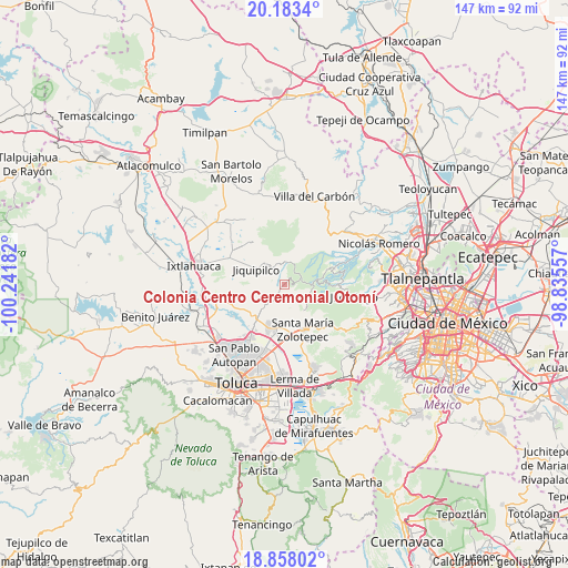
| Upper-left | 20.1834°, | -100.24182° |
| Center: | 19.52207°, | -99.53869° |
| Lower-right: | 18.85802°, | -98.83557° |
| Map W x H: | 147.4×147.4 km | = 91.6×91.6mi |
| max Lat: | 32.7° ⇑53.6% North |
| Colonia Centro Ceremonial Otomí: | 19.52207° |
| min Lat: | ⇓46.4% South 14.53588° |
| min Long | Colonia Centro | max Long |
| -117.105° | -99.53869° | -86.73105° |
| W 42.6%⇐ | ⇒57.4% E |
Elevation
Elevation of Colonia Centro Ceremonial Otomí is 3065 m = 10056 ft, and this is 1811.3 m = 5943 ft above average elevation for this country.
| Max E: |
3497 m = 11473 ft | 0.099999999999994% |
| Colonia Centro Ceremonial Otomí | 3065 m 10056 ft | |
| Avg. | 1253.7 m = 4113 ft | |
Min E: |
-1 m = -3 ft | 99.9% |
See also: Mexico elevation on elevation.city.
Geographical zone
Colonia Centro Ceremonial Otomí is located in North Torrid zone (between Equator and Tropic of Cancer). Distance of this Northern Tropic circle is 435.3 km =270.5 mi to North.| Distance of | km | miles | from Colonia Centro Ceremonial Otomí |
|---|---|---|---|
| North Pole | 7836.4 | 4869.3 | to North |
| Arctic Circle | 5230.5 | 3250.1 | to North |
| Tropic Cancer | 435.3 | 270.5 | to North |
| Equator | 2170.7 | 1348.8 | to South |


Nearby cities:
15 places around Colonia Centro Ceremonial Otomí: (largest is in red/bold)
• Barrio de Laurel 2da. Sección
4.6 km =2.9 mi,  220°
220°
• Enthavi
4.6 km =2.9 mi,  235°
235°
• Luis Donaldo Colosio Murrieta
4.8 km =3 mi, 242°
• Manzana Sexta Parte Alta
4.9 km =3 mi,  272°
272°
• Manzana Sexta Parte Baja
6.4 km =4 mi,  282°
282°
• Manzana Sexta Parte Centro
7 km =4.3 mi, 274°
• San Mateo Capulhuac
5.9 km =3.7 mi,  167°
167°
• San Pedro Abajo
5.5 km =3.4 mi,  212°
212°
• San Pedro Arriba
4.7 km =2.9 mi, 212°
• San Pedro Arriba 3ra. Sección
3.1 km =1.9 mi, 219°
• San Pedro Arriba 4ta. Sección (Cinco Reales)
4.9 km =3 mi, 217°
• Solalpan 1ra. Sección
5 km =3.1 mi,  229°
229°
• Tierra Blanca
5 km =3.1 mi,  250°
250°
• Tlaltenanguito
5.4 km =3.4 mi, 240°
• Zanja Vieja
5.1 km =3.2 mi, 235°
Sources, notices
• [Note1] Compared only with cities in Mexico existing in our database
• [Src1] Map data: © OpenStreetMap contributors (CC-BY-SA)
• [Src2] Other city data from geonames.org with taken over terms of usage.
• [Src3] Geographical zone / Annual Mean Temperature by Robert A. Rohde @ Wikipedia
