Barrio el Dajie geodata
Barrio el Dajie (Hidalgo) is a populated place; located in Mexico in America/Mexico_City (GMT-6) time zone. With population of 525 people, there are 16085 cities with bigger population in this country. Compared to other cities in Mexico, 59.7% of cities are located further ↓South; 51.3% of cities are located further ←West and 83.3% of cities have lower elevation than Barrio el Dajie. Note1


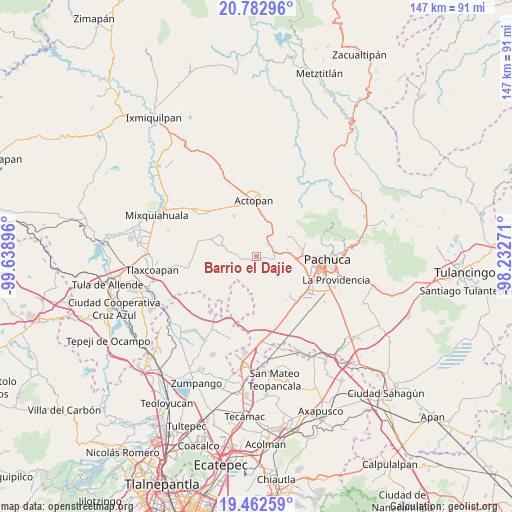
Barrio el Dajie GPS coordinates[2]
20° 7' 27.012" North, 98° 56' 8.988" West
| Map corner | latitude | longitude |
|---|---|---|
| Upper-left | 20.78296°, | -99.63896° |
| Center: | 20.12417°, | -98.93583° |
| Lower-right: | 19.46259°, | -98.23271° |
| Map W x H: | 146.8×146.8 km | = 91.2×91.2mi |
| max Lat: | 32.7° ⇑40.3% North |
| Barrio el Dajie: | 20.12417° |
| min Lat: | ⇓59.7% South 14.53588° |
| min Long | Barrio el Dajie | max Long |
| -117.105° | -98.93583° | -86.73105° |
| W 51.3%⇐ | ⇒48.7% E |
Elevation
Elevation of Barrio el Dajie is 2227 m = 7306 ft, and this is 973.3 m = 3193 ft above average elevation for this country.
| Max E: |
3497 m = 11473 ft | 16.7% |
| Barrio el Dajie | 2227 m 7306 ft | |
| Avg. | 1253.7 m = 4113 ft | |
Min E: |
-1 m = -3 ft | 83.3% |
See also: Mexico elevation on elevation.city.
Geographical zone
Barrio el Dajie is located in North Torrid zone (between Equator and Tropic of Cancer). Distance of this Northern Tropic circle is 368.3 km =228.9 mi to North.| Distance of | km | miles | from Barrio el Dajie |
|---|---|---|---|
| North Pole | 7769.5 | 4827.7 | to North |
| Arctic Circle | 5163.6 | 3208.5 | to North |
| Tropic Cancer | 368.3 | 228.9 | to North |
| Equator | 2237.6 | 1390.4 | to South |


Nearby cities:
15 places around Barrio el Dajie: (largest is in red/bold)
• Barrio de Españita
8.8 km =5.5 mi,  74°
74°
• Chicavasco
8.3 km =5.2 mi,  346°
346°
• El Bocja
9.7 km =6 mi,  9°
9°
• El Botho
5.3 km =3.3 mi, 72°
• El Chamizal
5 km =3.1 mi, 7°
• El Durazno
8.5 km =5.3 mi,  86°
86°
• El Tablón
10.9 km =6.8 mi,  328°
328°
• Ignacio Zaragoza
6.8 km =4.2 mi,  275°
275°
• Ixcuinquitlapilco
1.5 km =0.9 mi,  195°
195°
• La Manzana Uno
9 km =5.6 mi,  17°
17°
• Puerto México
7.3 km =4.5 mi,  245°
245°
• San Agustín Tlaxiaca
5.3 km =3.3 mi,  101°
101°
• San Francisco Tecajique
4.8 km =3 mi, 345°
• San Juan Solís
3.8 km =2.4 mi, 6°
• Santiago Tlapacoya
11.1 km =6.9 mi, 98°
Sources, notices
• [Note1] Compared only with cities in Mexico existing in our database
• [Src1] Map data: © OpenStreetMap contributors (CC-BY-SA)
• [Src2] Other city data from geonames.org with taken over terms of usage.
• [Src3] Geographical zone / Annual Mean Temperature by Robert A. Rohde @ Wikipedia
