Prinsenbeek geodata
Prinsenbeek (North Brabant) is a populated place; located in Netherlands in Europe/Amsterdam (GMT+2) time zone. With population of 10,720 people, there are 274 cities with bigger population in this country. Compared to other cities in Netherlands, 74.1% of cities are located further ↑North; 82.6% of cities are located further →East and 54.1% of cities have higher elevation than Prinsenbeek. Note1


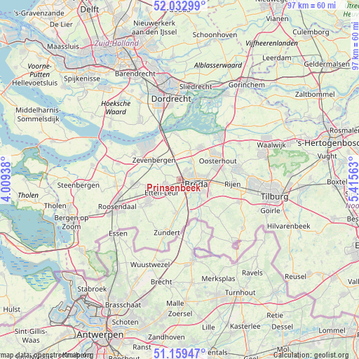
Prinsenbeek GPS coordinates[2]
51° 35' 53.988" North, 4° 42' 45" East
| Map corner | latitude | longitude |
|---|---|---|
| Upper-left | 52.03299°, | 4.00938° |
| Center: | 51.59833°, | 4.7125° |
| Lower-right: | 51.15947°, | 5.41563° |
| Map W x H: | 97.1×97.1 km | = 60.3×60.3mi |
| max Lat: | 53.48025° ⇑74.1% North |
| Prinsenbeek: | 51.59833° |
| min Lat: | ⇓25.9% South 50.76917° |
| min Long | Prinsenbeek | max Long |
| 3.38611° | 4.7125° | 7.16528° |
| W 17.4%⇐ | ⇒82.6% E |
Elevation
Elevation of Prinsenbeek is 5 m = 16 ft, and this is 10 m = 33 ft below average elevation for this country.
| Max E: |
203 m = 666 ft | 54.1% |
| Avg. | 15 m = 49 ft | |
| Prinsenbeek | 5 m = 16 ft | |
Min E: |
-6 m = -20 ft | 45.9% |
See also: Netherlands elevation on elevation.city.
Geographical zone
Prinsenbeek is located in North temperate zone (between Tropic of Cancer and the Arctic Circle). Distance of this North polar circle is 1664 km =1034 mi to North.| Distance of | km | miles | from Prinsenbeek |
|---|---|---|---|
| North Pole | 4269.9 | 2653.2 | to North |
| Arctic Circle | 1664 | 1034 | to North |
| Tropic Cancer | 3131.3 | 1945.7 | to South |
| Equator | 5737.2 | 3564.9 | to South |


Nearby cities:
15 places around Prinsenbeek: (largest is in red/bold)
• Belcrum
4 km =2.5 mi,  88°
88°
• Biesdonk
5.1 km =3.2 mi,  80°
80°
• Breda
4.6 km =2.9 mi,  106°
106°
• Gageldonk
1.9 km =1.2 mi, 78°
• Ginneken
6.6 km =4.1 mi,  122°
122°
• Heusdenhout
7.5 km =4.7 mi,  98°
98°
• Hoge Vucht
5.6 km =3.5 mi, 78°
• Langeweg
6.4 km =4 mi,  329°
329°
• Princenhage
3.1 km =1.9 mi,  143°
143°
• Terheijden
5.8 km =3.6 mi,  29°
29°
• Teteringen
7.6 km =4.7 mi, 80°
• Wagenberg
7.8 km =4.8 mi,  18°
18°
• Waterdonken
6.5 km =4 mi, 78°
• Wisselaar
5.2 km =3.2 mi,  71°
71°
• Zandberg
5.7 km =3.5 mi, 119°
Sources, notices
• [Note1] Compared only with cities in Netherlands existing in our database
• [Src1] Map data: © OpenStreetMap contributors (CC-BY-SA)
• [Src2] Other city data from geonames.org with taken over terms of usage.
• [Src3] Geographical zone / Annual Mean Temperature by Robert A. Rohde @ Wikipedia
