Balete geodata
Balete (Calabarzon) is a seat of a third-order administrative division; located in Philippines in Asia/Manila (GMT+8) time zone. With population of 8,662 people, there are 713 cities with bigger population in this country. Compared to other cities in Philippines, 69.3% of cities are located further ↓South; 73.9% of cities are located further →East and 60.8% of cities have higher elevation than Balete. Note1


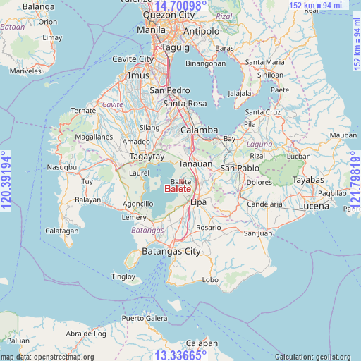
Balete GPS coordinates[2]
14° 1' 11.388" North, 121° 5' 42.216" East
| Map corner | latitude | longitude |
|---|---|---|
| Upper-left | 14.70098°, | 120.39194° |
| Center: | 14.01983°, | 121.09506° |
| Lower-right: | 13.33665°, | 121.79819° |
| Map W x H: | 151.7×151.7 km | = 94.3×94.3mi |
| max Lat: | 20.78733° ⇑30.7% North |
| Balete: | 14.01983° |
| min Lat: | ⇓69.3% South 4.65442° |
| min Long | Balete | max Long |
| 117.04868° | 121.09506° | 126.58417° |
| W 26.1%⇐ | ⇒73.9% E |
Elevation
Elevation of Balete is 16 m = 52 ft, and this is 71.9 m = 236 ft below average elevation for this country.
| Max E: |
2262 m = 7421 ft | 60.8% |
| Avg. | 87.9 m = 288 ft | |
| Balete | 16 m = 52 ft | |
Min E: |
-2 m = -7 ft | 39.2% |
See also: Philippines elevation on elevation.city.
Geographical zone
Balete is located in North Torrid zone (between Equator and Tropic of Cancer). Distance of this Northern Tropic circle is 1047.1 km =650.6 mi to North.| Distance of | km | miles | from Balete |
|---|---|---|---|
| North Pole | 8448.2 | 5249.5 | to North |
| Arctic Circle | 5842.3 | 3630.2 | to North |
| Tropic Cancer | 1047.1 | 650.6 | to North |
| Equator | 1558.9 | 968.7 | to South |


Nearby cities:
15 places around Balete: (largest is in red/bold)
• Ambulong
8.4 km =5.2 mi,  334°
334°
• Balele
5.1 km =3.2 mi,  358°
358°
• Boot
3.4 km =2.1 mi, 326°
• Bulacnin
5.8 km =3.6 mi,  124°
124°
• Janopol
7.3 km =4.5 mi, 359°
• Kinalaglagan
2.1 km =1.3 mi,  171°
171°
• Mahabang Parang
4.3 km =2.7 mi,  197°
197°
• Malabanan
4.7 km =2.9 mi, 118°
• Malvar
7.4 km =4.6 mi,  68°
68°
• Mataas Na Kahoy
7.1 km =4.4 mi,  163°
163°
• San Andres
6.3 km =3.9 mi,  106°
106°
• San Isidro
2.2 km =1.4 mi,  45°
45°
• San Pedro One
6.6 km =4.1 mi,  55°
55°
• Santor
8.5 km =5.3 mi,  9°
9°
• Tanauan
9.5 km =5.9 mi,  38°
38°
Sources, notices
• [Note1] Compared only with cities in Philippines existing in our database
• [Src1] Map data: © OpenStreetMap contributors (CC-BY-SA)
• [Src2] Other city data from geonames.org with taken over terms of usage.
• [Src3] Geographical zone / Annual Mean Temperature by Robert A. Rohde @ Wikipedia
