Vulpășești geodata
Vulpășești (Neamţ) is a populated place; located in Romania in Europe/Bucharest (GMT+3) time zone. With population of 788 people, there are 5107 cities with bigger population in this country. Compared to other cities in Romania, 78.4% of cities are located further ↓South; 84.1% of cities are located further ←West and 51.5% of cities have lower elevation than Vulpășești. Note1


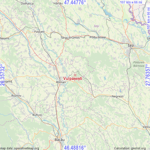
Vulpășești GPS coordinates[2]
46° 58' 12.396" North, 27° 3' 37.584" East
| Map corner | latitude | longitude |
|---|---|---|
| Upper-left | 47.44776°, | 26.35732° |
| Center: | 46.97011°, | 27.06044° |
| Lower-right: | 46.48816°, | 27.76357° |
| Map W x H: | 106.7×106.7 km | = 66.3×66.3mi |
| max Lat: | 48.23793° ⇑21.6% North |
| Vulpășești: | 46.97011° |
| min Lat: | ⇓78.4% South 43.65638° |
| min Long | Vulpășești | max Long |
| 20.31667° | 27.06044° | 29.65403° |
| W 84.1%⇐ | ⇒15.9% E |
Elevation
Elevation of Vulpășești is 219 m = 719 ft, and this is 35.9 m = 118 ft below average elevation for this country.
| Max E: |
1278 m = 4193 ft | 48.5% |
| Avg. | 254.9 m = 836 ft | |
| Vulpășești | 219 m = 719 ft | |
Min E: |
-2 m = -7 ft | 51.5% |
See also: Romania elevation on elevation.city.
Geographical zone
Vulpășești is located in North temperate zone (between Tropic of Cancer and the Arctic Circle). Distance of this North polar circle is 2178.6 km =1353.7 mi to North.| Distance of | km | miles | from Vulpășești |
|---|---|---|---|
| North Pole | 4784.5 | 2972.9 | to North |
| Arctic Circle | 2178.6 | 1353.7 | to North |
| Tropic Cancer | 2616.7 | 1625.9 | to South |
| Equator | 5222.6 | 3245.2 | to South |


Nearby cities:
15 places around Vulpășești: (largest is in red/bold)
• Adjudeni
9.8 km =6.1 mi,  300°
300°
• Boghicea
9.4 km =5.8 mi,  4°
4°
• Buhonca
10.2 km =6.3 mi,  327°
327°
• Buruienești
6.9 km =4.3 mi,  294°
294°
• Bâra
7.1 km =4.4 mi,  353°
353°
• Dagâţa
10.2 km =6.3 mi,  113°
113°
• Doljeşti
9.1 km =5.7 mi,  320°
320°
• Gâdinţi
5.3 km =3.3 mi,  219°
219°
• Poienile
10.2 km =6.3 mi, 113°
• Pânceşti
10.3 km =6.4 mi,  136°
136°
• Rediu
6.1 km =3.8 mi, 316°
• Rotunda
9.4 km =5.8 mi,  307°
307°
• Sagna
3.6 km =2.2 mi, 293°
• Stăniţa
6 km =3.7 mi,  30°
30°
• Tămăşeni
9.8 km =6.1 mi,  278°
278°
Sources, notices
• [Note1] Compared only with cities in Romania existing in our database
• [Src1] Map data: © OpenStreetMap contributors (CC-BY-SA)
• [Src2] Other city data from geonames.org with taken over terms of usage.
• [Src3] Geographical zone / Annual Mean Temperature by Robert A. Rohde @ Wikipedia
