Voivodeni geodata
Voivodeni (Braşov) is a populated place; located in Romania in Europe/Bucharest (GMT+3) time zone. With population of 556 people, there are 6529 cities with bigger population in this country. Compared to other cities in Romania, 50.3% of cities are located further ↑North; 54.6% of cities are located further →East and 87% of cities have lower elevation than Voivodeni. Note1


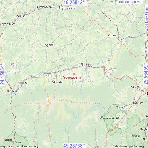
Voivodeni GPS coordinates[2]
45° 46' 47.676" North, 24° 51' 41.256" East
| Map corner | latitude | longitude |
|---|---|---|
| Upper-left | 46.26812°, | 24.15834° |
| Center: | 45.77991°, | 24.86146° |
| Lower-right: | 45.28738°, | 25.56459° |
| Map W x H: | 109×109 km | = 67.7×67.7mi |
| max Lat: | 48.23793° ⇑50.3% North |
| Voivodeni: | 45.77991° |
| min Lat: | ⇓49.7% South 43.65638° |
| min Long | Voivodeni | max Long |
| 20.31667° | 24.86146° | 29.65403° |
| W 45.4%⇐ | ⇒54.6% E |
Elevation
Elevation of Voivodeni is 470 m = 1542 ft, and this is 215.1 m = 706 ft above average elevation for this country.
| Max E: |
1278 m = 4193 ft | 13% |
| Voivodeni | 470 m 1542 ft | |
| Avg. | 254.9 m = 836 ft | |
Min E: |
-2 m = -7 ft | 87% |
See also: Romania elevation on elevation.city.
Geographical zone
Voivodeni is located in North temperate zone (between Tropic of Cancer and the Arctic Circle). Distance of this North polar circle is 2310.9 km =1435.9 mi to North.| Distance of | km | miles | from Voivodeni |
|---|---|---|---|
| North Pole | 4916.8 | 3055.2 | to North |
| Arctic Circle | 2310.9 | 1435.9 | to North |
| Tropic Cancer | 2484.3 | 1543.7 | to South |
| Equator | 5090.2 | 3162.9 | to South |


Nearby cities:
15 places around Voivodeni: (largest is in red/bold)
• Beclean
7.4 km =4.6 mi,  39°
39°
• Berivoi
10.8 km =6.7 mi,  118°
118°
• Breaza
8.4 km =5.2 mi,  168°
168°
• Cincșor
6.7 km =4.2 mi,  341°
341°
• Copăcel
11 km =6.8 mi,  110°
110°
• Drăguș
6.7 km =4.2 mi,  252°
252°
• Ileni
10.9 km =6.8 mi,  85°
85°
• Lisa
7.1 km =4.4 mi,  187°
187°
• Olteț
8.1 km =5 mi,  289°
289°
• Recea
9.2 km =5.7 mi,  143°
143°
• Sâmbăta de Jos
4.7 km =2.9 mi,  318°
318°
• Sâmbăta de Sus
3.8 km =2.4 mi,  237°
237°
• Viștea de Jos
10.8 km =6.7 mi,  279°
279°
• Viștea de Sus
10 km =6.2 mi, 247°
• Voila
4.5 km =2.8 mi, 340°
Sources, notices
• [Note1] Compared only with cities in Romania existing in our database
• [Src1] Map data: © OpenStreetMap contributors (CC-BY-SA)
• [Src2] Other city data from geonames.org with taken over terms of usage.
• [Src3] Geographical zone / Annual Mean Temperature by Robert A. Rohde @ Wikipedia
