Văcăreni geodata
Văcăreni (Tulcea) is a seat of a second-order administrative division; located in Romania in Europe/Bucharest (GMT+3) time zone. With population of 2,339 people, there are 2279 cities with bigger population in this country. Compared to other cities in Romania, 58.3% of cities are located further ↑North; 97.7% of cities are located further ←West and 96.4% of cities have higher elevation than Văcăreni. Note1


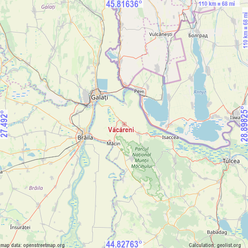
Văcăreni GPS coordinates[2]
45° 19' 26.94" North, 28° 11' 42.432" East
| Map corner | latitude | longitude |
|---|---|---|
| Upper-left | 45.81636°, | 27.492° |
| Center: | 45.32415°, | 28.19512° |
| Lower-right: | 44.82763°, | 28.89825° |
| Map W x H: | 109.9×109.9 km | = 68.3×68.3mi |
| max Lat: | 48.23793° ⇑58.3% North |
| Văcăreni: | 45.32415° |
| min Lat: | ⇓41.7% South 43.65638° |
| min Long | Văcăreni | max Long |
| 20.31667° | 28.19512° | 29.65403° |
| W 97.7%⇐ | ⇒2.3% E |
Elevation
Elevation of Văcăreni is 27 m = 89 ft, and this is 227.9 m = 748 ft below average elevation for this country.
| Max E: |
1278 m = 4193 ft | 96.4% |
| Avg. | 254.9 m = 836 ft | |
| Văcăreni | 27 m = 89 ft | |
Min E: |
-2 m = -7 ft | 3.6% |
See also: Romania elevation on elevation.city.
Geographical zone
Văcăreni is located in North temperate zone (between Tropic of Cancer and the Arctic Circle). Distance of this North polar circle is 2361.6 km =1467.4 mi to North.| Distance of | km | miles | from Văcăreni |
|---|---|---|---|
| North Pole | 4967.5 | 3086.7 | to North |
| Arctic Circle | 2361.6 | 1467.4 | to North |
| Tropic Cancer | 2433.7 | 1512.2 | to South |
| Equator | 5039.6 | 3131.5 | to South |


Nearby cities:
15 places around Văcăreni: (largest is in red/bold)
• Brăila
18.2 km =11.3 mi,  251°
251°
• Carcaliu
16.1 km =10 mi,  192°
192°
• Galaţi
16.9 km =10.5 mi,  317°
317°
• Garvăn
3.6 km =2.2 mi,  314°
314°
• Greci
15.9 km =9.9 mi,  169°
169°
• Grindu
8.6 km =5.3 mi,  11°
11°
• I. C. Brătianu
14.3 km =8.9 mi, 309°
• Jijila
4.4 km =2.7 mi,  232°
232°
• Luncaviţa
7.2 km =4.5 mi,  129°
129°
• Movileni
20.4 km =12.7 mi,  296°
296°
• Măcin
10.1 km =6.3 mi,  207°
207°
• Rachelu
10.9 km =6.8 mi,  112°
112°
• Revărsarea
16.5 km =10.3 mi, 109°
• Smârdan
15.5 km =9.6 mi, 254°
• Vădeni
21 km =13 mi,  283°
283°
Sources, notices
• [Note1] Compared only with cities in Romania existing in our database
• [Src1] Map data: © OpenStreetMap contributors (CC-BY-SA)
• [Src2] Other city data from geonames.org with taken over terms of usage.
• [Src3] Geographical zone / Annual Mean Temperature by Robert A. Rohde @ Wikipedia
