Turcoaia geodata
Turcoaia (Tulcea) is a seat of a second-order administrative division; located in Romania in Europe/Bucharest (GMT+3) time zone. With population of 3,646 people, there are 1351 cities with bigger population in this country. Compared to other cities in Romania, 64.9% of cities are located further ↑North; 97.7% of cities are located further ←West and 99.9% of cities have higher elevation than Turcoaia. Note1


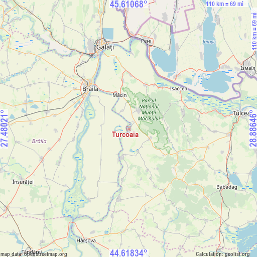
Turcoaia GPS coordinates[2]
45° 7' 0.012" North, 28° 10' 59.988" East
| Map corner | latitude | longitude |
|---|---|---|
| Upper-left | 45.61068°, | 27.48021° |
| Center: | 45.11667°, | 28.18333° |
| Lower-right: | 44.61834°, | 28.88646° |
| Map W x H: | 110.3×110.3 km | = 68.5×68.5mi |
| max Lat: | 48.23793° ⇑64.9% North |
| Turcoaia: | 45.11667° |
| min Lat: | ⇓35.1% South 43.65638° |
| min Long | Turcoaia | max Long |
| 20.31667° | 28.18333° | 29.65403° |
| W 97.7%⇐ | ⇒2.3% E |
Elevation
Elevation of Turcoaia is 2 m = 7 ft, and this is 252.9 m = 830 ft below average elevation for this country.
| Max E: |
1278 m = 4193 ft | 99.9% |
| Avg. | 254.9 m = 836 ft | |
| Turcoaia | 2 m = 7 ft | |
Min E: |
-2 m = -7 ft | 0.1% |
See also: Romania elevation on elevation.city.
Geographical zone
Turcoaia is located in North temperate zone (between Tropic of Cancer and the Arctic Circle). Distance of this North polar circle is 2384.7 km =1481.8 mi to North.| Distance of | km | miles | from Turcoaia |
|---|---|---|---|
| North Pole | 4990.6 | 3101 | to North |
| Arctic Circle | 2384.7 | 1481.8 | to North |
| Tropic Cancer | 2410.6 | 1497.9 | to South |
| Equator | 5016.5 | 3117.1 | to South |


Nearby cities:
15 places around Turcoaia: (largest is in red/bold)
• Carcaliu
7.9 km =4.9 mi,  340°
340°
• Cerna
11.1 km =6.9 mi,  109°
109°
• Chiscani
21 km =13 mi,  290°
290°
• Cârjelari
21.1 km =13.1 mi,  144°
144°
• Dorobanţu
19.7 km =12.2 mi,  160°
160°
• Greci
8.4 km =5.2 mi,  27°
27°
• Hamcearca
14.4 km =8.9 mi,  90°
90°
• Jijila
20.6 km =12.8 mi,  352°
352°
• Luncaviţa
19.6 km =12.2 mi,  19°
19°
• Mircea Vodă
16.1 km =10 mi,  123°
123°
• Măcin
14.6 km =9.1 mi, 345°
• Ostrov
20.6 km =12.8 mi,  187°
187°
• Peceneaga
11.8 km =7.3 mi,  199°
199°
• Titcov
14.1 km =8.8 mi, 198°
• Traian
10.6 km =6.6 mi, 157°
Sources, notices
• [Note1] Compared only with cities in Romania existing in our database
• [Src1] Map data: © OpenStreetMap contributors (CC-BY-SA)
• [Src2] Other city data from geonames.org with taken over terms of usage.
• [Src3] Geographical zone / Annual Mean Temperature by Robert A. Rohde @ Wikipedia
