Stâncești geodata
Stâncești (Botoşani) is a populated place; located in Romania in Europe/Bucharest (GMT+3) time zone. With population of 1,072 people, there are 4060 cities with bigger population in this country. Compared to other cities in Romania, 95.6% of cities are located further ↓South; 74.6% of cities are located further ←West and 63.4% of cities have higher elevation than Stâncești. Note1


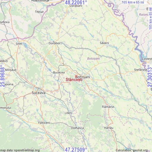
Stâncești GPS coordinates[2]
47° 45' 0" North, 26° 36' 0" East
| Map corner | latitude | longitude |
|---|---|---|
| Upper-left | 48.22061°, | 25.89688° |
| Center: | 47.75°, | 26.6° |
| Lower-right: | 47.27509°, | 27.30313° |
| Map W x H: | 105.1×105.1 km | = 65.3×65.3mi |
| max Lat: | 48.23793° ⇑4.4% North |
| Stâncești: | 47.75° |
| min Lat: | ⇓95.6% South 43.65638° |
| min Long | Stâncești | max Long |
| 20.31667° | 26.6° | 29.65403° |
| W 74.6%⇐ | ⇒25.4% E |
Elevation
Elevation of Stâncești is 153 m = 502 ft, and this is 101.9 m = 334 ft below average elevation for this country.
| Max E: |
1278 m = 4193 ft | 63.4% |
| Avg. | 254.9 m = 836 ft | |
| Stâncești | 153 m = 502 ft | |
Min E: |
-2 m = -7 ft | 36.6% |
See also: Romania elevation on elevation.city.
Geographical zone
Stâncești is located in North temperate zone (between Tropic of Cancer and the Arctic Circle). Distance of this North polar circle is 2091.9 km =1299.8 mi to North.| Distance of | km | miles | from Stâncești |
|---|---|---|---|
| North Pole | 4697.8 | 2919.1 | to North |
| Arctic Circle | 2091.9 | 1299.8 | to North |
| Tropic Cancer | 2703.4 | 1679.8 | to South |
| Equator | 5309.3 | 3299 | to South |


Nearby cities:
15 places around Stâncești: (largest is in red/bold)
• Botoşani
5 km =3.1 mi,  90°
90°
• Brehuiești
6.8 km =4.2 mi,  217°
217°
• Băiceni
7.7 km =4.8 mi,  145°
145°
• Cervicești
8.5 km =5.3 mi,  309°
309°
• Costești
8 km =5 mi,  45°
45°
• Cucorăni
7.2 km =4.5 mi,  300°
300°
• Curteşti
5.3 km =3.3 mi,  134°
134°
• Cătămărești
2.1 km =1.3 mi,  276°
276°
• Cătămărești-Deal
2.2 km =1.4 mi,  358°
358°
• Ipotești
3.6 km =2.2 mi, 300°
• Mândrești
8.9 km =5.5 mi,  258°
258°
• Roma
9.3 km =5.8 mi,  0°
0°
• Roșiori
9.2 km =5.7 mi,  82°
82°
• Răchiţi
6.5 km =4 mi,  73°
73°
• Vlădeni
7.3 km =4.5 mi,  239°
239°
Sources, notices
• [Note1] Compared only with cities in Romania existing in our database
• [Src1] Map data: © OpenStreetMap contributors (CC-BY-SA)
• [Src2] Other city data from geonames.org with taken over terms of usage.
• [Src3] Geographical zone / Annual Mean Temperature by Robert A. Rohde @ Wikipedia
