Stâlpeni geodata
Stâlpeni (Arges) is a seat of a second-order administrative division; located in Romania in Europe/Bucharest (GMT+3) time zone. With population of 5,088 people, there are 753 cities with bigger population in this country. Compared to other cities in Romania, 67.8% of cities are located further ↑North; 53.1% of cities are located further →East and 75.4% of cities have lower elevation than Stâlpeni. Note1


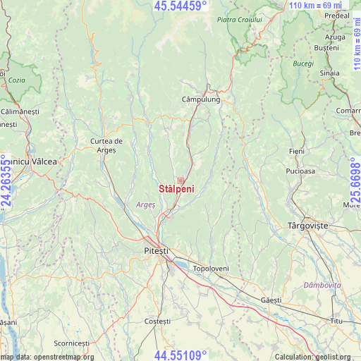
Stâlpeni GPS coordinates[2]
45° 3' 0" North, 24° 58' 0.012" East
| Map corner | latitude | longitude |
|---|---|---|
| Upper-left | 45.54459°, | 24.26355° |
| Center: | 45.05°, | 24.96667° |
| Lower-right: | 44.55109°, | 25.6698° |
| Map W x H: | 110.5×110.5 km | = 68.7×68.7mi |
| max Lat: | 48.23793° ⇑67.8% North |
| Stâlpeni: | 45.05° |
| min Lat: | ⇓32.2% South 43.65638° |
| min Long | Stâlpeni | max Long |
| 20.31667° | 24.96667° | 29.65403° |
| W 46.9%⇐ | ⇒53.1% E |
Elevation
Elevation of Stâlpeni is 356 m = 1168 ft, and this is 101.1 m = 332 ft above average elevation for this country.
| Max E: |
1278 m = 4193 ft | 24.6% |
| Stâlpeni | 356 m 1168 ft | |
| Avg. | 254.9 m = 836 ft | |
Min E: |
-2 m = -7 ft | 75.4% |
See also: Romania elevation on elevation.city.
Geographical zone
Stâlpeni is located in North temperate zone (between Tropic of Cancer and the Arctic Circle). Distance of this North polar circle is 2392.1 km =1486.4 mi to North.| Distance of | km | miles | from Stâlpeni |
|---|---|---|---|
| North Pole | 4998 | 3105.6 | to North |
| Arctic Circle | 2392.1 | 1486.4 | to North |
| Tropic Cancer | 2403.2 | 1493.3 | to South |
| Equator | 5009.1 | 3112.5 | to South |


Nearby cities:
15 places around Stâlpeni: (largest is in red/bold)
• Bucșenești-Lotași
4.1 km =2.5 mi,  178°
178°
• Băjești
3.4 km =2.1 mi,  218°
218°
• Bălileşti
3.2 km =2 mi,  305°
305°
• Davideşti
6.4 km =4 mi,  125°
125°
• Dărmăneşti
6.4 km =4 mi,  234°
234°
• Livezeni
1.5 km =0.9 mi,  148°
148°
• Petrești
6.1 km =3.8 mi,  263°
263°
• Poienița
7.5 km =4.7 mi,  336°
336°
• Rădești
3.7 km =2.3 mi,  48°
48°
• Titeşti
4.5 km =2.8 mi,  144°
144°
• Valea Mare-Bratia
2.8 km =1.7 mi,  333°
333°
• Valea Mănăstirii
4.5 km =2.8 mi, 127°
• Valea Nandrii
7.6 km =4.7 mi,  242°
242°
• Valea Popii
6.4 km =4 mi,  42°
42°
• Valea Stânii
7 km =4.3 mi, 181°
Sources, notices
• [Note1] Compared only with cities in Romania existing in our database
• [Src1] Map data: © OpenStreetMap contributors (CC-BY-SA)
• [Src2] Other city data from geonames.org with taken over terms of usage.
• [Src3] Geographical zone / Annual Mean Temperature by Robert A. Rohde @ Wikipedia
