Şilindia geodata
Şilindia (Arad) is a seat of a second-order administrative division; located in Romania in Europe/Bucharest (GMT+3) time zone. With population of 943 people, there are 4475 cities with bigger population in this country. Compared to other cities in Romania, 63.3% of cities are located further ↓South; 95.1% of cities are located further →East and 65.2% of cities have higher elevation than Şilindia. Note1


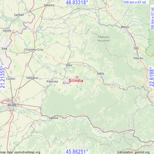
Şilindia GPS coordinates[2]
46° 21' 0" North, 21° 55' 0.012" East
| Map corner | latitude | longitude |
|---|---|---|
| Upper-left | 46.83318°, | 21.21355° |
| Center: | 46.35°, | 21.91667° |
| Lower-right: | 45.86251°, | 22.6198° |
| Map W x H: | 107.9×107.9 km | = 67×67mi |
| max Lat: | 48.23793° ⇑36.7% North |
| Şilindia: | 46.35° |
| min Lat: | ⇓63.3% South 43.65638° |
| min Long | Şilindia | max Long |
| 20.31667° | 21.91667° | 29.65403° |
| W 4.9%⇐ | ⇒95.1% E |
Elevation
Elevation of Şilindia is 146 m = 479 ft, and this is 108.9 m = 357 ft below average elevation for this country.
| Max E: |
1278 m = 4193 ft | 65.2% |
| Avg. | 254.9 m = 836 ft | |
| Şilindia | 146 m = 479 ft | |
Min E: |
-2 m = -7 ft | 34.8% |
See also: Romania elevation on elevation.city.
Geographical zone
Şilindia is located in North temperate zone (between Tropic of Cancer and the Arctic Circle). Distance of this North polar circle is 2247.5 km =1396.5 mi to North.| Distance of | km | miles | from Şilindia |
|---|---|---|---|
| North Pole | 4853.4 | 3015.8 | to North |
| Arctic Circle | 2247.5 | 1396.5 | to North |
| Tropic Cancer | 2547.7 | 1583.1 | to South |
| Equator | 5153.6 | 3202.3 | to South |


Nearby cities:
15 places around Şilindia: (largest is in red/bold)
• Agrișu Mare
15.1 km =9.4 mi,  235°
235°
• Aldești
10.8 km =6.7 mi,  62°
62°
• Bocsig
7.8 km =4.8 mi,  19°
19°
• Bârsa
12.1 km =7.5 mi,  72°
72°
• Chier
7.1 km =4.4 mi,  262°
262°
• Cuied
8.2 km =5.1 mi,  99°
99°
• Drauț
12.9 km =8 mi,  219°
219°
• Dud
7.3 km =4.5 mi, 218°
• Ineu
11 km =6.8 mi,  327°
327°
• Mocrea
8.4 km =5.2 mi,  299°
299°
• Moroda
11.9 km =7.4 mi,  280°
280°
• Nadăș
14.1 km =8.8 mi,  169°
169°
• Răpsig
11.2 km =7 mi,  45°
45°
• Tauţ
7.4 km =4.6 mi,  180°
180°
• Târnova
9.7 km =6 mi,  247°
247°
Sources, notices
• [Note1] Compared only with cities in Romania existing in our database
• [Src1] Map data: © OpenStreetMap contributors (CC-BY-SA)
• [Src2] Other city data from geonames.org with taken over terms of usage.
• [Src3] Geographical zone / Annual Mean Temperature by Robert A. Rohde @ Wikipedia
