Sătuc geodata
Sătuc (Brăila) is a populated place; located in Romania in Europe/Bucharest (GMT+3) time zone. With population of 802 people, there are 5037 cities with bigger population in this country. Compared to other cities in Romania, 62% of cities are located further ↑North; 86.2% of cities are located further ←West and 90.7% of cities have higher elevation than Sătuc. Note1


Sătuc GPS coordinates[2]
45° 11' 8.196" North, 27° 9' 22.824" East
| Map corner | latitude | longitude |
|---|---|---|
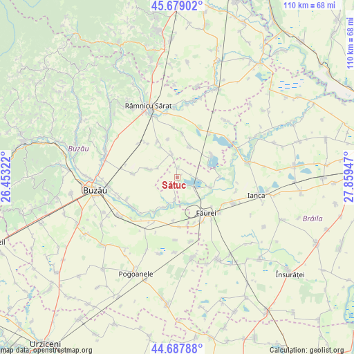
| Upper-left | 45.67902°, | 26.45322° |
| Center: | 45.18561°, | 27.15634° |
| Lower-right: | 44.68788°, | 27.85947° |
| Map W x H: | 110.2×110.2 km | = 68.5×68.5mi |
| max Lat: | 48.23793° ⇑62% North |
| Sătuc: | 45.18561° |
| min Lat: | ⇓38% South 43.65638° |
| min Long | Sătuc | max Long |
| 20.31667° | 27.15634° | 29.65403° |
| W 86.2%⇐ | ⇒13.8% E |
Elevation
Elevation of Sătuc is 55 m = 180 ft, and this is 199.9 m = 656 ft below average elevation for this country.
| Max E: |
1278 m = 4193 ft | 90.7% |
| Avg. | 254.9 m = 836 ft | |
| Sătuc | 55 m = 180 ft | |
Min E: |
-2 m = -7 ft | 9.3% |
See also: Romania elevation on elevation.city.
Geographical zone
Sătuc is located in North temperate zone (between Tropic of Cancer and the Arctic Circle). Distance of this North polar circle is 2377 km =1477 mi to North.| Distance of | km | miles | from Sătuc |
|---|---|---|---|
| North Pole | 4982.9 | 3096.2 | to North |
| Arctic Circle | 2377 | 1477 | to North |
| Tropic Cancer | 2418.2 | 1502.6 | to South |
| Equator | 5024.2 | 3121.9 | to South |


Nearby cities:
15 places around Sătuc: (largest is in red/bold)
• Amara
12.8 km =8 mi,  56°
56°
• Bălăceanu
9 km =5.6 mi,  356°
356°
• Cochirleanca
10.2 km =6.3 mi,  289°
289°
• Cotu Ciorii
13.7 km =8.5 mi,  184°
184°
• Drogu
5.9 km =3.7 mi,  93°
93°
• Galbenu
3.5 km =2.2 mi,  13°
13°
• Ghergheasa
9.6 km =6 mi,  20°
20°
• Găvănești
13 km =8.1 mi,  213°
213°
• Heliade Rădulescu
12.1 km =7.5 mi,  346°
346°
• Jirlău
2.3 km =1.4 mi,  158°
158°
• Lanurile
10.8 km =6.7 mi,  330°
330°
• Moșești
6.9 km =4.3 mi,  185°
185°
• Robeasca
2.8 km =1.7 mi,  220°
220°
• Roșioru
6.6 km =4.1 mi,  295°
295°
• Vişani
10.7 km =6.6 mi,  111°
111°
Sources, notices
• [Note1] Compared only with cities in Romania existing in our database
• [Src1] Map data: © OpenStreetMap contributors (CC-BY-SA)
• [Src2] Other city data from geonames.org with taken over terms of usage.
• [Src3] Geographical zone / Annual Mean Temperature by Robert A. Rohde @ Wikipedia
