Răchita geodata
Răchita (Alba) is a populated place; located in Romania in Europe/Bucharest (GMT+3) time zone. With population of 737 people, there are 5354 cities with bigger population in this country. Compared to other cities in Romania, 52.1% of cities are located further ↓South; 76.7% of cities are located further →East and 84.5% of cities have lower elevation than Răchita. Note1


Răchita GPS coordinates[2]
45° 52' 31.188" North, 23° 31' 1.452" East
| Map corner | latitude | longitude |
|---|---|---|
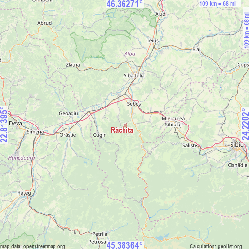
| Upper-left | 46.36271°, | 22.81395° |
| Center: | 45.87533°, | 23.51707° |
| Lower-right: | 45.38364°, | 24.2202° |
| Map W x H: | 108.9×108.9 km | = 67.7×67.7mi |
| max Lat: | 48.23793° ⇑47.9% North |
| Răchita: | 45.87533° |
| min Lat: | ⇓52.1% South 43.65638° |
| min Long | Răchita | max Long |
| 20.31667° | 23.51707° | 29.65403° |
| W 23.3%⇐ | ⇒76.7% E |
Elevation
Elevation of Răchita is 440 m = 1444 ft, and this is 185.1 m = 607 ft above average elevation for this country.
| Max E: |
1278 m = 4193 ft | 15.5% |
| Răchita | 440 m 1444 ft | |
| Avg. | 254.9 m = 836 ft | |
Min E: |
-2 m = -7 ft | 84.5% |
See also: Romania elevation on elevation.city.
Geographical zone
Răchita is located in North temperate zone (between Tropic of Cancer and the Arctic Circle). Distance of this North polar circle is 2300.3 km =1429.3 mi to North.| Distance of | km | miles | from Răchita |
|---|---|---|---|
| North Pole | 4906.2 | 3048.6 | to North |
| Arctic Circle | 2300.3 | 1429.3 | to North |
| Tropic Cancer | 2494.9 | 1550.3 | to South |
| Equator | 5100.9 | 3169.6 | to South |


Nearby cities:
15 places around Răchita: (largest is in red/bold)
• Câlnic
11.6 km =7.2 mi,  85°
85°
• Căpâlna
7.5 km =4.7 mi,  115°
115°
• Deal
8.7 km =5.4 mi,  101°
101°
• Loman
3.4 km =2.1 mi, 124°
• Mărtinie
11.6 km =7.2 mi,  141°
141°
• Petrești
6.1 km =3.8 mi,  33°
33°
• Pianu de Jos
7 km =4.3 mi,  342°
342°
• Pianu de Sus
3.8 km =2.4 mi,  316°
316°
• Răhău
8.7 km =5.4 mi,  69°
69°
• Sebeş
9.9 km =6.2 mi,  24°
24°
• Sebeșel
4 km =2.5 mi, 70°
• Săliştea-Deal
9.5 km =5.9 mi,  286°
286°
• Săliștea
9.9 km =6.2 mi, 291°
• Săsciori
5.2 km =3.2 mi, 100°
• Tărtăria
10.3 km =6.4 mi,  308°
308°
Sources, notices
• [Note1] Compared only with cities in Romania existing in our database
• [Src1] Map data: © OpenStreetMap contributors (CC-BY-SA)
• [Src2] Other city data from geonames.org with taken over terms of usage.
• [Src3] Geographical zone / Annual Mean Temperature by Robert A. Rohde @ Wikipedia
