Odăile geodata
Odăile (Buzău) is a seat of a second-order administrative division; located in Romania in Europe/Bucharest (GMT+3) time zone. With population of 1,080 people, there are 4040 cities with bigger population in this country. Compared to other cities in Romania, 57.4% of cities are located further ↑North; 73.7% of cities are located further ←West and 82.3% of cities have lower elevation than Odăile. Note1


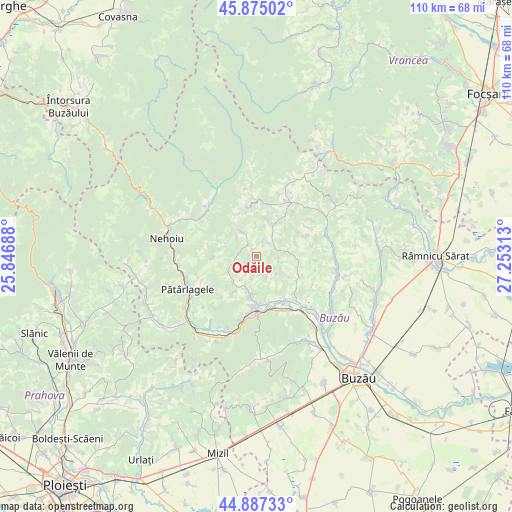
Odăile GPS coordinates[2]
45° 22' 59.988" North, 26° 33' 0" East
| Map corner | latitude | longitude |
|---|---|---|
| Upper-left | 45.87502°, | 25.84688° |
| Center: | 45.38333°, | 26.55° |
| Lower-right: | 44.88733°, | 27.25313° |
| Map W x H: | 109.8×109.8 km | = 68.2×68.2mi |
| max Lat: | 48.23793° ⇑57.4% North |
| Odăile: | 45.38333° |
| min Lat: | ⇓42.6% South 43.65638° |
| min Long | Odăile | max Long |
| 20.31667° | 26.55° | 29.65403° |
| W 73.7%⇐ | ⇒26.3% E |
Elevation
Elevation of Odăile is 415 m = 1362 ft, and this is 160.1 m = 525 ft above average elevation for this country.
| Max E: |
1278 m = 4193 ft | 17.7% |
| Odăile | 415 m 1362 ft | |
| Avg. | 254.9 m = 836 ft | |
Min E: |
-2 m = -7 ft | 82.3% |
See also: Romania elevation on elevation.city.
Geographical zone
Odăile is located in North temperate zone (between Tropic of Cancer and the Arctic Circle). Distance of this North polar circle is 2355 km =1463.3 mi to North.| Distance of | km | miles | from Odăile |
|---|---|---|---|
| North Pole | 4960.9 | 3082.6 | to North |
| Arctic Circle | 2355 | 1463.3 | to North |
| Tropic Cancer | 2440.2 | 1516.3 | to South |
| Equator | 5046.2 | 3135.6 | to South |


Nearby cities:
15 places around Odăile: (largest is in red/bold)
• Bozioru
5.2 km =3.2 mi,  270°
270°
• Brăeşti
6.8 km =4.2 mi,  324°
324°
• Brătilești
10.9 km =6.8 mi,  331°
331°
• Chiliile
7.9 km =4.9 mi,  19°
19°
• Cozieni
7.6 km =4.7 mi,  223°
223°
• Căneşti
4.3 km =2.7 mi,  64°
64°
• Ivănețu
9.5 km =5.9 mi, 331°
• Joseni
11.4 km =7.1 mi,  133°
133°
• Lopătari
11.4 km =7.1 mi,  13°
13°
• Lunca Frumoasă
8.5 km =5.3 mi,  185°
185°
• Plaiu Nucului
11.2 km =7 mi,  349°
349°
• Policiori
9.8 km =6.1 mi,  121°
121°
• Pârscov
11.1 km =6.9 mi,  180°
180°
• Rătești
12.2 km =7.6 mi,  142°
142°
• Scorţoasa
8.9 km =5.5 mi,  103°
103°
Sources, notices
• [Note1] Compared only with cities in Romania existing in our database
• [Src1] Map data: © OpenStreetMap contributors (CC-BY-SA)
• [Src2] Other city data from geonames.org with taken over terms of usage.
• [Src3] Geographical zone / Annual Mean Temperature by Robert A. Rohde @ Wikipedia
