Dorgoş geodata
Dorgoş (Arad) is a populated place; located in Romania in Europe/Bucharest (GMT+3) time zone. With population of 1,368 people, there are 3402 cities with bigger population in this country. Compared to other cities in Romania, 56% of cities are located further ↓South; 95.6% of cities are located further →East and 63.7% of cities have higher elevation than Dorgoş. Note1


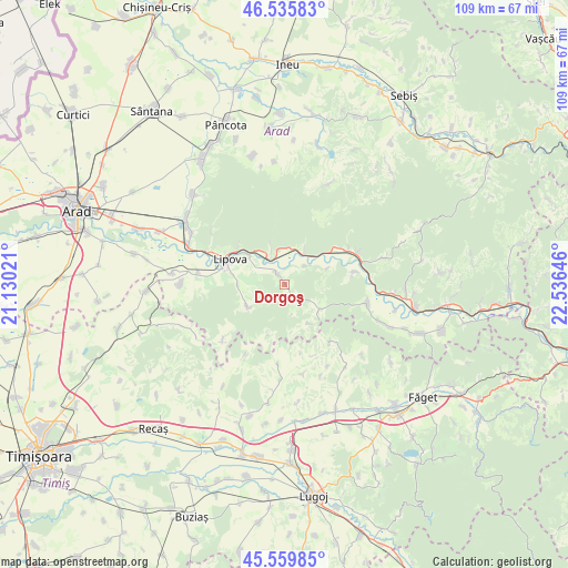
Dorgoş GPS coordinates[2]
46° 3' 0" North, 21° 49' 59.988" East
| Map corner | latitude | longitude |
|---|---|---|
| Upper-left | 46.53583°, | 21.13021° |
| Center: | 46.05°, | 21.83333° |
| Lower-right: | 45.55985°, | 22.53646° |
| Map W x H: | 108.5×108.5 km | = 67.4×67.4mi |
| max Lat: | 48.23793° ⇑44% North |
| Dorgoş: | 46.05° |
| min Lat: | ⇓56% South 43.65638° |
| min Long | Dorgoş | max Long |
| 20.31667° | 21.83333° | 29.65403° |
| W 4.4%⇐ | ⇒95.6% E |
Elevation
Elevation of Dorgoş is 152 m = 499 ft, and this is 102.9 m = 338 ft below average elevation for this country.
| Max E: |
1278 m = 4193 ft | 63.7% |
| Avg. | 254.9 m = 836 ft | |
| Dorgoş | 152 m = 499 ft | |
Min E: |
-2 m = -7 ft | 36.3% |
See also: Romania elevation on elevation.city.
Geographical zone
Dorgoş is located in North temperate zone (between Tropic of Cancer and the Arctic Circle). Distance of this North polar circle is 2280.9 km =1417.3 mi to North.| Distance of | km | miles | from Dorgoş |
|---|---|---|---|
| North Pole | 4886.8 | 3036.5 | to North |
| Arctic Circle | 2280.9 | 1417.3 | to North |
| Tropic Cancer | 2514.4 | 1562.4 | to South |
| Equator | 5120.3 | 3181.6 | to South |


Nearby cities:
15 places around Dorgoş: (largest is in red/bold)
• Bara
17.5 km =10.9 mi,  170°
170°
• Bata
15.9 km =9.9 mi,  103°
103°
• Bârzava
13.7 km =8.5 mi,  57°
57°
• Chesinț
19.6 km =12.2 mi,  269°
269°
• Conop
6.8 km =4.2 mi,  31°
31°
• Lalașinț
13.8 km =8.6 mi,  80°
80°
• Lipova
11.5 km =7.1 mi,  293°
293°
• Milova
6.7 km =4.2 mi,  338°
338°
• Neudorf
16.7 km =10.4 mi,  277°
277°
• Ohaba Lungă
19.7 km =12.2 mi,  143°
143°
• Radna
12.3 km =7.6 mi, 293°
• Secaş
18.4 km =11.4 mi,  183°
183°
• Ususău
2.7 km =1.7 mi,  326°
326°
• Şiştarovăţ
8.6 km =5.3 mi,  244°
244°
• Șoimoș
10.8 km =6.7 mi,  305°
305°
Sources, notices
• [Note1] Compared only with cities in Romania existing in our database
• [Src1] Map data: © OpenStreetMap contributors (CC-BY-SA)
• [Src2] Other city data from geonames.org with taken over terms of usage.
• [Src3] Geographical zone / Annual Mean Temperature by Robert A. Rohde @ Wikipedia
