Cristolţ geodata
Cristolţ (Sălaj) is a seat of a second-order administrative division; located in Romania in Europe/Bucharest (GMT+3) time zone. With population of 1,516 people, there are 3144 cities with bigger population in this country. Compared to other cities in Romania, 83.9% of cities are located further ↓South; 78.1% of cities are located further →East and 74.9% of cities have lower elevation than Cristolţ. Note1


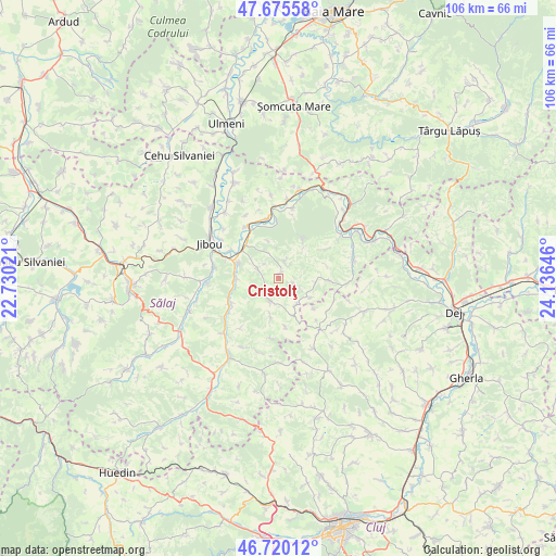
Cristolţ GPS coordinates[2]
47° 12' 0" North, 23° 25' 59.988" East
| Map corner | latitude | longitude |
|---|---|---|
| Upper-left | 47.67558°, | 22.73021° |
| Center: | 47.2°, | 23.43333° |
| Lower-right: | 46.72012°, | 24.13646° |
| Map W x H: | 106.2×106.2 km | = 66×66mi |
| max Lat: | 48.23793° ⇑16.1% North |
| Cristolţ: | 47.2° |
| min Lat: | ⇓83.9% South 43.65638° |
| min Long | Cristolţ | max Long |
| 20.31667° | 23.43333° | 29.65403° |
| W 21.9%⇐ | ⇒78.1% E |
Elevation
Elevation of Cristolţ is 352 m = 1155 ft, and this is 97.1 m = 319 ft above average elevation for this country.
| Max E: |
1278 m = 4193 ft | 25.1% |
| Cristolţ | 352 m 1155 ft | |
| Avg. | 254.9 m = 836 ft | |
Min E: |
-2 m = -7 ft | 74.9% |
See also: Romania elevation on elevation.city.
Geographical zone
Cristolţ is located in North temperate zone (between Tropic of Cancer and the Arctic Circle). Distance of this North polar circle is 2153 km =1337.8 mi to North.| Distance of | km | miles | from Cristolţ |
|---|---|---|---|
| North Pole | 4758.9 | 2957 | to North |
| Arctic Circle | 2153 | 1337.8 | to North |
| Tropic Cancer | 2642.2 | 1641.8 | to South |
| Equator | 5248.1 | 3261 | to South |


Nearby cities:
15 places around Cristolţ: (largest is in red/bold)
• Băbeni
11.4 km =7.1 mi,  347°
347°
• Bălan
10.4 km =6.5 mi,  241°
241°
• Chechiș
9.7 km =6 mi,  253°
253°
• Ciocmani
11.8 km =7.3 mi,  328°
328°
• Cristolțel
5.4 km =3.4 mi,  336°
336°
• Gâlgău Almaşului
7.6 km =4.7 mi,  270°
270°
• Gârbou
5.6 km =3.5 mi,  180°
180°
• Hășmaș
13.2 km =8.2 mi,  94°
94°
• Lozna
13.2 km =8.2 mi,  10°
10°
• Solomon
3.2 km =2 mi,  201°
201°
• Surduc
8.4 km =5.2 mi,  311°
311°
• Tihău
8.4 km =5.2 mi,  291°
291°
• Var
10.8 km =6.7 mi, 291°
• Văleni
3.4 km =2.1 mi,  17°
17°
• Zalha
7.8 km =4.8 mi,  103°
103°
Sources, notices
• [Note1] Compared only with cities in Romania existing in our database
• [Src1] Map data: © OpenStreetMap contributors (CC-BY-SA)
• [Src2] Other city data from geonames.org with taken over terms of usage.
• [Src3] Geographical zone / Annual Mean Temperature by Robert A. Rohde @ Wikipedia
