Coroieni geodata
Coroieni (Maramureş) is a seat of a second-order administrative division; located in Romania in Europe/Bucharest (GMT+3) time zone. With population of 376 people, there are 7042 cities with bigger population in this country. Compared to other cities in Romania, 88.1% of cities are located further ↓South; 73.1% of cities are located further →East and 80.1% of cities have lower elevation than Coroieni. Note1


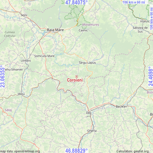
Coroieni GPS coordinates[2]
47° 22' 0.012" North, 23° 46' 0.012" East
| Map corner | latitude | longitude |
|---|---|---|
| Upper-left | 47.84075°, | 23.06355° |
| Center: | 47.36667°, | 23.76667° |
| Lower-right: | 46.88829°, | 24.4698° |
| Map W x H: | 105.9×105.9 km | = 65.8×65.8mi |
| max Lat: | 48.23793° ⇑11.9% North |
| Coroieni: | 47.36667° |
| min Lat: | ⇓88.1% South 43.65638° |
| min Long | Coroieni | max Long |
| 20.31667° | 23.76667° | 29.65403° |
| W 26.9%⇐ | ⇒73.1% E |
Elevation
Elevation of Coroieni is 394 m = 1293 ft, and this is 139.1 m = 456 ft above average elevation for this country.
| Max E: |
1278 m = 4193 ft | 19.9% |
| Coroieni | 394 m 1293 ft | |
| Avg. | 254.9 m = 836 ft | |
Min E: |
-2 m = -7 ft | 80.1% |
See also: Romania elevation on elevation.city.
Geographical zone
Coroieni is located in North temperate zone (between Tropic of Cancer and the Arctic Circle). Distance of this North polar circle is 2134.5 km =1326.3 mi to North.| Distance of | km | miles | from Coroieni |
|---|---|---|---|
| North Pole | 4740.4 | 2945.5 | to North |
| Arctic Circle | 2134.5 | 1326.3 | to North |
| Tropic Cancer | 2660.8 | 1653.3 | to South |
| Equator | 5266.7 | 3272.6 | to South |


Nearby cities:
15 places around Coroieni: (largest is in red/bold)
• Baba
3.3 km =2.1 mi,  208°
208°
• Boiu Mare
14.3 km =8.9 mi,  285°
285°
• Borcut
14 km =8.7 mi,  23°
23°
• Chiuiești
11.3 km =7 mi,  133°
133°
• Copalnic Mănăştur
16.1 km =10 mi,  337°
337°
• Dămăcușeni
14.7 km =9.1 mi,  46°
46°
• Glod
12.1 km =7.5 mi,  225°
225°
• Gostila
5.6 km =3.5 mi,  149°
149°
• Gâlgău
10.6 km =6.6 mi, 207°
• Ileanda
10.7 km =6.6 mi,  249°
249°
• Poiana Blenchii
7.5 km =4.7 mi,  189°
189°
• Rus
15.6 km =9.7 mi, 233°
• Târgu Lăpuş
12.1 km =7.5 mi,  37°
37°
• Vima Mică
5.3 km =3.3 mi,  314°
314°
• Vălenii Lăpușului
4.6 km =2.9 mi, 18°
Sources, notices
• [Note1] Compared only with cities in Romania existing in our database
• [Src1] Map data: © OpenStreetMap contributors (CC-BY-SA)
• [Src2] Other city data from geonames.org with taken over terms of usage.
• [Src3] Geographical zone / Annual Mean Temperature by Robert A. Rohde @ Wikipedia
