Belciug geodata
Belciug (Teleorman) is a populated place; located in Romania in Europe/Bucharest (GMT+3) time zone. With population of 579 people, there are 6363 cities with bigger population in this country. Compared to other cities in Romania, 91.6% of cities are located further ↑North; 51.1% of cities are located further →East and 75.6% of cities have higher elevation than Belciug. Note1


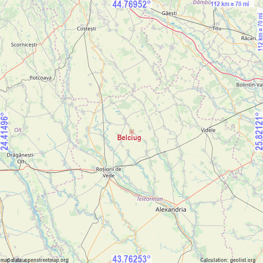
Belciug GPS coordinates[2]
44° 16' 5.448" North, 25° 7' 5.088" East
| Map corner | latitude | longitude |
|---|---|---|
| Upper-left | 44.76952°, | 24.41496° |
| Center: | 44.26818°, | 25.11808° |
| Lower-right: | 43.76253°, | 25.82121° |
| Map W x H: | 112×112 km | = 69.6×69.6mi |
| max Lat: | 48.23793° ⇑91.6% North |
| Belciug: | 44.26818° |
| min Lat: | ⇓8.4% South 43.65638° |
| min Long | Belciug | max Long |
| 20.31667° | 25.11808° | 29.65403° |
| W 48.9%⇐ | ⇒51.1% E |
Elevation
Elevation of Belciug is 108 m = 354 ft, and this is 146.9 m = 482 ft below average elevation for this country.
| Max E: |
1278 m = 4193 ft | 75.6% |
| Avg. | 254.9 m = 836 ft | |
| Belciug | 108 m = 354 ft | |
Min E: |
-2 m = -7 ft | 24.4% |
See also: Romania elevation on elevation.city.
Geographical zone
Belciug is located in North temperate zone (between Tropic of Cancer and the Arctic Circle). Distance of this Northern Tropic circle is 2316.2 km =1439.2 mi to South.| Distance of | km | miles | from Belciug |
|---|---|---|---|
| North Pole | 5084.9 | 3159.6 | to North |
| Arctic Circle | 2479 | 1540.4 | to North |
| Tropic Cancer | 2316.2 | 1439.2 | to South |
| Equator | 4922.2 | 3058.5 | to South |


Nearby cities:
15 places around Belciug: (largest is in red/bold)
• Baldovinești
9.3 km =5.8 mi,  328°
328°
• Brătășani
11.2 km =7 mi,  110°
110°
• Butculești
7 km =4.3 mi,  211°
211°
• Ciolăneștii din Vale
3.3 km =2.1 mi,  339°
339°
• Ciurari
6 km =3.7 mi,  255°
255°
• Deparați
8.4 km =5.2 mi,  80°
80°
• Drăcșenei
11.5 km =7.1 mi,  246°
246°
• Gărăgău
7 km =4.3 mi,  125°
125°
• Necşeşti
3.2 km =2 mi, 128°
• Sfinţeşti
9.5 km =5.9 mi,  188°
188°
• Slăvești
10.3 km =6.4 mi,  38°
38°
• Săceni
5.6 km =3.5 mi,  226°
226°
• Trivalea-Moşteni
9.2 km =5.7 mi,  91°
91°
• Vârtoapele de Jos
11.5 km =7.1 mi,  145°
145°
• Vârtoapele de Sus
10.7 km =6.6 mi,  142°
142°
Sources, notices
• [Note1] Compared only with cities in Romania existing in our database
• [Src1] Map data: © OpenStreetMap contributors (CC-BY-SA)
• [Src2] Other city data from geonames.org with taken over terms of usage.
• [Src3] Geographical zone / Annual Mean Temperature by Robert A. Rohde @ Wikipedia
