Hajdučica geodata
Hajdučica (Vojvodina) is a populated place; located in Serbia in Europe/Belgrade (GMT+2) time zone. With population of 1,519 people, there are 261 cities with bigger population in this country. Compared to other cities in Serbia, 73.2% of cities are located further ↓South; 73.2% of cities are located further ←West and 96.4% of cities have higher elevation than Hajdučica. Note1


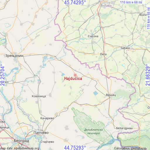
Hajdučica GPS coordinates[2]
45° 15' 0.36" North, 20° 57' 36.576" East
| Map corner | latitude | longitude |
|---|---|---|
| Upper-left | 45.74295°, | 20.25704° |
| Center: | 45.2501°, | 20.96016° |
| Lower-right: | 44.75293°, | 21.66329° |
| Map W x H: | 110.1×110.1 km | = 68.4×68.4mi |
| max Lat: | 46.1° ⇑26.8% North |
| Hajdučica: | 45.2501° |
| min Lat: | ⇓73.2% South 42.25846° |
| min Long | Hajdučica | max Long |
| 18.9276° | 20.96016° | 22.77556° |
| W 73.2%⇐ | ⇒26.8% E |
Elevation
Elevation of Hajdučica is 74 m = 243 ft, and this is 102.4 m = 336 ft below average elevation for this country.
| Max E: |
1421 m = 4662 ft | 96.4% |
| Avg. | 176.4 m = 579 ft | |
| Hajdučica | 74 m = 243 ft | |
Min E: |
49 m = 161 ft | 3.6% |
See also: Serbia elevation on elevation.city.
Geographical zone
Hajdučica is located in North temperate zone (between Tropic of Cancer and the Arctic Circle). Distance of this North polar circle is 2369.8 km =1472.5 mi to North.| Distance of | km | miles | from Hajdučica |
|---|---|---|---|
| North Pole | 4975.7 | 3091.8 | to North |
| Arctic Circle | 2369.8 | 1472.5 | to North |
| Tropic Cancer | 2425.4 | 1507.1 | to South |
| Equator | 5031.3 | 3126.3 | to South |


Nearby cities:
15 places around Hajdučica: (largest is in red/bold)
• Banatska Dubica
10.6 km =6.6 mi,  282°
282°
• Barice
12.2 km =7.6 mi,  128°
128°
• Dobrica
9.5 km =5.9 mi,  244°
244°
• Ilandža
9.6 km =6 mi,  199°
199°
• Janošik
9.5 km =5.9 mi,  157°
157°
• Jermenovci
9.7 km =6 mi,  136°
136°
• Konak
8.1 km =5 mi,  334°
334°
• Kozjak
10.6 km =6.6 mi,  225°
225°
• Kupinik
14.6 km =9.1 mi,  71°
71°
• Lokve
12.2 km =7.6 mi,  153°
153°
• Miletićevo
10.2 km =6.3 mi,  53°
53°
• Plandište
12.9 km =8 mi,  101°
101°
• Seleuš
14.1 km =8.8 mi,  194°
194°
• Stari Lec
3.8 km =2.4 mi,  4°
4°
• Velika Greda
5.9 km =3.7 mi, 96°
Sources, notices
• [Note1] Compared only with cities in Serbia existing in our database
• [Src1] Map data: © OpenStreetMap contributors (CC-BY-SA)
• [Src2] Other city data from geonames.org with taken over terms of usage.
• [Src3] Geographical zone / Annual Mean Temperature by Robert A. Rohde @ Wikipedia
