Kurilovo geodata
Kurilovo (Moscow Oblast) is a populated place; located in Russia in Europe/Moscow (GMT+3) time zone. With population of 1,738 people, there are 4277 cities with bigger population in this country. Compared to other cities in Russia, 56.9% of cities are located further ↓South; 82.9% of cities are located further →East and 65% of cities have lower elevation than Kurilovo. Note1


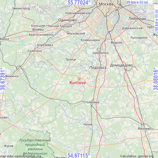
Kurilovo GPS coordinates[2]
55° 22' 21.756" North, 37° 22' 37.308" East
| Map corner | latitude | longitude |
|---|---|---|
| Upper-left | 55.77024°, | 36.67391° |
| Center: | 55.37271°, | 37.37703° |
| Lower-right: | 54.97115°, | 38.08016° |
| Map W x H: | 88.9×88.8 km | = 55.2×55.2mi |
| max Lat: | 73.50819° ⇑43.1% North |
| Kurilovo: | 55.37271° |
| min Lat: | ⇓56.9% South 41.28413° |
| min Long | Kurilovo | max Long |
| -179.12198° | 37.37703° | 179.35046° |
| W 17.1%⇐ | ⇒82.9% E |
Elevation
Elevation of Kurilovo is 182 m = 597 ft, and this is 20.6 m = 68 ft below average elevation for this country.
| Max E: |
2518 m = 8261 ft | 35% |
| Avg. | 202.6 m = 665 ft | |
| Kurilovo | 182 m = 597 ft | |
Min E: |
-28 m = -92 ft | 65% |
See also: Russia elevation on elevation.city.
Geographical zone
Kurilovo is located in North temperate zone (between Tropic of Cancer and the Arctic Circle). Distance of this North polar circle is 1244.3 km =773.2 mi to North.| Distance of | km | miles | from Kurilovo |
|---|---|---|---|
| North Pole | 3850.2 | 2392.4 | to North |
| Arctic Circle | 1244.3 | 773.2 | to North |
| Tropic Cancer | 3550.9 | 2206.4 | to South |
| Equator | 6156.9 | 3825.7 | to South |


Nearby cities:
15 places around Kurilovo: (largest is in red/bold)
• Chepelëvo
22.3 km =13.9 mi,  160°
160°
• Dubrovitsy
10.2 km =6.3 mi,  42°
42°
• Filimonki
20.7 km =12.9 mi,  354°
354°
• Klimovsk
9.7 km =6 mi,  96°
96°
• Krasnaya Pahra
9.5 km =5.9 mi,  314°
314°
• LMS
13.7 km =8.5 mi,  241°
241°
• Lyubuchany
17.4 km =10.8 mi,  141°
141°
• L’vovskiy
11 km =6.8 mi,  122°
122°
• Podolsk
12.6 km =7.8 mi,  62°
62°
• Posëlok Mar’ino
20 km =12.4 mi, 349°
• Shcherbinka
18.2 km =11.3 mi, 39°
• Shishkin Les
12.6 km =7.8 mi,  289°
289°
• Stolbovaya
15.5 km =9.6 mi,  151°
151°
• Troitsk
13.2 km =8.2 mi,  340°
340°
• Vatutinki
14.1 km =8.8 mi, 347°
Sources, notices
• [Note1] Compared only with cities in Russia existing in our database
• [Src1] Map data: © OpenStreetMap contributors (CC-BY-SA)
• [Src2] Other city data from geonames.org with taken over terms of usage.
• [Src3] Geographical zone / Annual Mean Temperature by Robert A. Rohde @ Wikipedia
