Sudogda geodata
Sudogda (Vladimir) is a populated place; located in Russia in Europe/Moscow (GMT+3) time zone. With population of 13,277 people, there are 1187 cities with bigger population in this country. Compared to other cities in Russia, 65.9% of cities are located further ↓South; 63.6% of cities are located further →East and 71.9% of cities have higher elevation than Sudogda. Note1


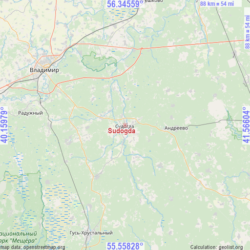
Sudogda GPS coordinates[2]
55° 57' 14.184" North, 40° 51' 46.476" East
| Map corner | latitude | longitude |
|---|---|---|
| Upper-left | 56.34559°, | 40.15979° |
| Center: | 55.95394°, | 40.86291° |
| Lower-right: | 55.55828°, | 41.56604° |
| Map W x H: | 87.5×87.5 km | = 54.4×54.4mi |
| max Lat: | 73.50819° ⇑34.1% North |
| Sudogda: | 55.95394° |
| min Lat: | ⇓65.9% South 41.28413° |
| min Long | Sudogda | max Long |
| -179.12198° | 40.86291° | 179.35046° |
| W 36.4%⇐ | ⇒63.6% E |
Elevation
Elevation of Sudogda is 98 m = 322 ft, and this is 104.6 m = 343 ft below average elevation for this country.
| Max E: |
2518 m = 8261 ft | 71.9% |
| Avg. | 202.6 m = 665 ft | |
| Sudogda | 98 m = 322 ft | |
Min E: |
-28 m = -92 ft | 28.1% |
See also: Russia elevation on elevation.city.
Geographical zone
Sudogda is located in North temperate zone (between Tropic of Cancer and the Arctic Circle). Distance of this North polar circle is 1179.7 km =733 mi to North.| Distance of | km | miles | from Sudogda |
|---|---|---|---|
| North Pole | 3785.6 | 2352.3 | to North |
| Arctic Circle | 1179.7 | 733 | to North |
| Tropic Cancer | 3615.6 | 2246.6 | to South |
| Equator | 6221.5 | 3865.9 | to South |


Nearby cities:
15 places around Sudogda: (largest is in red/bold)
• Andreyevo
17.9 km =11.1 mi,  92°
92°
• Anopino
31 km =19.3 mi,  203°
203°
• Bogolyubovo
33.7 km =20.9 mi,  321°
321°
• Golovino
27.3 km =17 mi,  271°
271°
• Gusevskiy
37.5 km =23.3 mi,  210°
210°
• Imeni Vorovskogo
30.2 km =18.8 mi,  148°
148°
• Ivanishchi
33.7 km =20.9 mi,  233°
233°
• Kommunar
31.3 km =19.4 mi,  304°
304°
• Krasnyy Bogatyr’
17.9 km =11.1 mi,  67°
67°
• Krasnyy Mayak
33.2 km =20.6 mi, 71°
• Krasnyy Oktyabr’
36.4 km =22.6 mi,  62°
62°
• Muromtsevo
3.8 km =2.4 mi,  132°
132°
• Orgtrud
29.8 km =18.5 mi,  328°
328°
• Raduzhnyy
33.1 km =20.6 mi,  279°
279°
• Vladimir
35.4 km =22 mi,  305°
305°
Sources, notices
• [Note1] Compared only with cities in Russia existing in our database
• [Src1] Map data: © OpenStreetMap contributors (CC-BY-SA)
• [Src2] Other city data from geonames.org with taken over terms of usage.
• [Src3] Geographical zone / Annual Mean Temperature by Robert A. Rohde @ Wikipedia
