Pavlovka geodata
Pavlovka (Ulyanovsk) is a populated place; located in Russia in Europe/Ulyanovsk (GMT+4) time zone. With population of 5,878 people, there are 2304 cities with bigger population in this country. Compared to other cities in Russia, 58.1% of cities are located further ↑North; 55.2% of cities are located further ←West and 80.9% of cities have lower elevation than Pavlovka. Note1


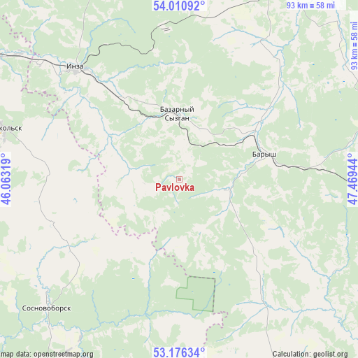
Pavlovka GPS coordinates[2]
53° 35' 44.484" North, 46° 45' 58.716" East
| Map corner | latitude | longitude |
|---|---|---|
| Upper-left | 54.01092°, | 46.06319° |
| Center: | 53.59569°, | 46.76631° |
| Lower-right: | 53.17634°, | 47.46944° |
| Map W x H: | 92.8×92.8 km | = 57.7×57.7mi |
| max Lat: | 73.50819° ⇑58.1% North |
| Pavlovka: | 53.59569° |
| min Lat: | ⇓41.9% South 41.28413° |
| min Long | Pavlovka | max Long |
| -179.12198° | 46.76631° | 179.35046° |
| W 55.2%⇐ | ⇒44.8% E |
Elevation
Elevation of Pavlovka is 257 m = 843 ft, and this is 54.4 m = 178 ft above average elevation for this country.
| Max E: |
2518 m = 8261 ft | 19.1% |
| Pavlovka | 257 m 843 ft | |
| Avg. | 202.6 m = 665 ft | |
Min E: |
-28 m = -92 ft | 80.9% |
See also: Russia elevation on elevation.city.
Geographical zone
Pavlovka is located in North temperate zone (between Tropic of Cancer and the Arctic Circle). Distance of this North polar circle is 1441.9 km =896 mi to North.| Distance of | km | miles | from Pavlovka |
|---|---|---|---|
| North Pole | 4047.8 | 2515.2 | to North |
| Arctic Circle | 1441.9 | 896 | to North |
| Tropic Cancer | 3353.4 | 2083.7 | to South |
| Equator | 5959.3 | 3702.9 | to South |


Nearby cities:
15 places around Pavlovka: (largest is in red/bold)
• Barysh
23.8 km =14.8 mi,  73°
73°
• Bazarnyy Syzgan
17.3 km =10.7 mi,  357°
357°
• Glotovka
39.5 km =24.5 mi,  354°
354°
• Imeni Vladimira Il’icha Lenina
14.5 km =9 mi,  103°
103°
• Inderka
51.2 km =31.8 mi,  221°
221°
• Inza
39.6 km =24.6 mi,  317°
317°
• Izmaylovo
34.5 km =21.4 mi, 66°
• Kuznetsk
54.4 km =33.8 mi,  191°
191°
• Nikol’sk
47.8 km =29.7 mi,  286°
286°
• Poselki
54.4 km =33.8 mi,  198°
198°
• Sosnovoborsk
48.2 km =30 mi,  225°
225°
• Starotimoshkino
52.2 km =32.4 mi, 74°
• Veshkayma
55.6 km =34.5 mi,  25°
25°
• Zarechnyy
52.8 km =32.8 mi, 193°
• Zhadovka
12.3 km =7.6 mi, 100°
Sources, notices
• [Note1] Compared only with cities in Russia existing in our database
• [Src1] Map data: © OpenStreetMap contributors (CC-BY-SA)
• [Src2] Other city data from geonames.org with taken over terms of usage.
• [Src3] Geographical zone / Annual Mean Temperature by Robert A. Rohde @ Wikipedia
