Muranovo geodata
Muranovo (Moscow Oblast) is a populated place; located in Russia in Europe/Moscow (GMT+3) time zone. With population of 6,500 people, there are 2123 cities with bigger population in this country. Compared to other cities in Russia, 69.1% of cities are located further ↓South; 78% of cities are located further →East and 76.7% of cities have lower elevation than Muranovo. Note1


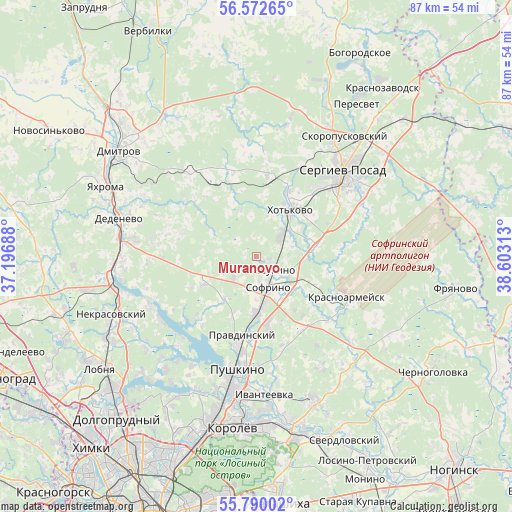
Muranovo GPS coordinates[2]
56° 10' 59.988" North, 37° 54' 0" East
| Map corner | latitude | longitude |
|---|---|---|
| Upper-left | 56.57265°, | 37.19688° |
| Center: | 56.18333°, | 37.9° |
| Lower-right: | 55.79002°, | 38.60313° |
| Map W x H: | 87×87 km | = 54.1×54.1mi |
| max Lat: | 73.50819° ⇑30.9% North |
| Muranovo: | 56.18333° |
| min Lat: | ⇓69.1% South 41.28413° |
| min Long | Muranovo | max Long |
| -179.12198° | 37.9° | 179.35046° |
| W 22%⇐ | ⇒78% E |
Elevation
Elevation of Muranovo is 225 m = 738 ft, and this is 22.4 m = 73 ft above average elevation for this country.
| Max E: |
2518 m = 8261 ft | 23.3% |
| Muranovo | 225 m 738 ft | |
| Avg. | 202.6 m = 665 ft | |
Min E: |
-28 m = -92 ft | 76.7% |
See also: Russia elevation on elevation.city.
Geographical zone
Muranovo is located in North temperate zone (between Tropic of Cancer and the Arctic Circle). Distance of this North polar circle is 1154.2 km =717.2 mi to North.| Distance of | km | miles | from Muranovo |
|---|---|---|---|
| North Pole | 3760.1 | 2336.4 | to North |
| Arctic Circle | 1154.2 | 717.2 | to North |
| Tropic Cancer | 3641.1 | 2262.5 | to South |
| Equator | 6247 | 3881.7 | to South |


Nearby cities:
15 places around Muranovo: (largest is in red/bold)
• Ashukino
3.6 km =2.2 mi,  120°
120°
• Bogoslovo
21.2 km =13.2 mi,  150°
150°
• Bratovshchina
14.9 km =9.3 mi,  183°
183°
• Khot'kovo
10.1 km =6.3 mi,  35°
35°
• Kostino
16.7 km =10.4 mi, 176°
• Krasnoarmeysk
17.2 km =10.7 mi, 122°
• Lesnoy
13 km =8.1 mi, 175°
• Pravdinskiy
13.9 km =8.6 mi,  189°
189°
• Pushkino
18.6 km =11.6 mi, 186°
• Semkhoz
15.2 km =9.4 mi, 42°
• Sergiyev Posad
19.4 km =12.1 mi,  48°
48°
• Sofrino
4.2 km =2.6 mi, 150°
• Yel’digino
9 km =5.6 mi,  214°
214°
• Zelenogradskiy
9.3 km =5.8 mi,  173°
173°
• Zhukovka
16.1 km =10 mi,  157°
157°
Sources, notices
• [Note1] Compared only with cities in Russia existing in our database
• [Src1] Map data: © OpenStreetMap contributors (CC-BY-SA)
• [Src2] Other city data from geonames.org with taken over terms of usage.
• [Src3] Geographical zone / Annual Mean Temperature by Robert A. Rohde @ Wikipedia
