Lopandino geodata
Lopandino (Bryansk Oblast) is a populated place; located in Russia in Europe/Moscow (GMT+3) time zone. With population of 1,938 people, there are 4200 cities with bigger population in this country. Compared to other cities in Russia, 66.4% of cities are located further ↑North; 89.2% of cities are located further →East and 68.4% of cities have lower elevation than Lopandino. Note1


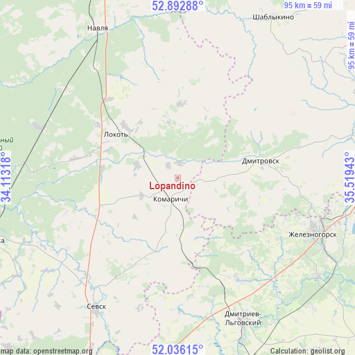
Lopandino GPS coordinates[2]
52° 27' 59.76" North, 34° 48' 58.68" East
| Map corner | latitude | longitude |
|---|---|---|
| Upper-left | 52.89288°, | 34.11318° |
| Center: | 52.4666°, | 34.8163° |
| Lower-right: | 52.03615°, | 35.51943° |
| Map W x H: | 95.3×95.3 km | = 59.2×59.2mi |
| max Lat: | 73.50819° ⇑66.4% North |
| Lopandino: | 52.4666° |
| min Lat: | ⇓33.6% South 41.28413° |
| min Long | Lopandino | max Long |
| -179.12198° | 34.8163° | 179.35046° |
| W 10.8%⇐ | ⇒89.2% E |
Elevation
Elevation of Lopandino is 192 m = 630 ft, and this is 10.6 m = 35 ft below average elevation for this country.
| Max E: |
2518 m = 8261 ft | 31.6% |
| Avg. | 202.6 m = 665 ft | |
| Lopandino | 192 m = 630 ft | |
Min E: |
-28 m = -92 ft | 68.4% |
See also: Russia elevation on elevation.city.
Geographical zone
Lopandino is located in North temperate zone (between Tropic of Cancer and the Arctic Circle). Distance of this North polar circle is 1567.4 km =973.9 mi to North.| Distance of | km | miles | from Lopandino |
|---|---|---|---|
| North Pole | 4173.3 | 2593.2 | to North |
| Arctic Circle | 1567.4 | 973.9 | to North |
| Tropic Cancer | 3227.8 | 2005.7 | to South |
| Equator | 5833.7 | 3624.9 | to South |


Nearby cities:
15 places around Lopandino: (largest is in red/bold)
• Altukhovo
38.2 km =23.7 mi,  307°
307°
• Dmitrovsk-Orlovskiy
22.8 km =14.2 mi,  79°
79°
• Khomutovka
63.1 km =39.2 mi,  195°
195°
• Kokino
4.1 km =2.5 mi,  324°
324°
• Kokorevka
39.4 km =24.5 mi,  289°
289°
• Komarichi
6 km =3.7 mi, 196°
• Lokot’
19.5 km =12.1 mi,  304°
304°
• Mikhaylovka
46.2 km =28.7 mi,  124°
124°
• Navlya
45.3 km =28.1 mi,  331°
331°
• Pervoavgustovskiy
31.3 km =19.4 mi,  148°
148°
• Sevsk
41.6 km =25.8 mi,  211°
211°
• Shablykino
50.4 km =31.3 mi,  30°
30°
• Soskovo
49.4 km =30.7 mi,  50°
50°
• Suzëmka
52.7 km =32.7 mi,  251°
251°
• Zheleznogorsk
40.5 km =25.2 mi,  111°
111°
Sources, notices
• [Note1] Compared only with cities in Russia existing in our database
• [Src1] Map data: © OpenStreetMap contributors (CC-BY-SA)
• [Src2] Other city data from geonames.org with taken over terms of usage.
• [Src3] Geographical zone / Annual Mean Temperature by Robert A. Rohde @ Wikipedia
