Khorlovo geodata
Khorlovo (Moscow Oblast) is a populated place; located in Russia in Europe/Moscow (GMT+3) time zone. With population of 3,852 people, there are 3190 cities with bigger population in this country. Compared to other cities in Russia, 56.5% of cities are located further ↓South; 73.1% of cities are located further →East and 50.7% of cities have higher elevation than Khorlovo. Note1


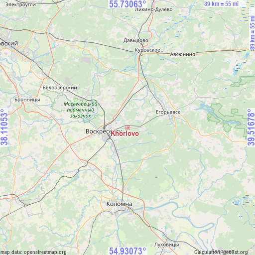
Khorlovo GPS coordinates[2]
55° 19' 57.72" North, 38° 48' 49.14" East
| Map corner | latitude | longitude |
|---|---|---|
| Upper-left | 55.73063°, | 38.11053° |
| Center: | 55.3327°, | 38.81365° |
| Lower-right: | 54.93073°, | 39.51678° |
| Map W x H: | 88.9×88.9 km | = 55.2×55.2mi |
| max Lat: | 73.50819° ⇑43.5% North |
| Khorlovo: | 55.3327° |
| min Lat: | ⇓56.5% South 41.28413° |
| min Long | Khorlovo | max Long |
| -179.12198° | 38.81365° | 179.35046° |
| W 26.9%⇐ | ⇒73.1% E |
Elevation
Elevation of Khorlovo is 143 m = 469 ft, and this is 59.6 m = 196 ft below average elevation for this country.
| Max E: |
2518 m = 8261 ft | 50.7% |
| Avg. | 202.6 m = 665 ft | |
| Khorlovo | 143 m = 469 ft | |
Min E: |
-28 m = -92 ft | 49.3% |
See also: Russia elevation on elevation.city.
Geographical zone
Khorlovo is located in North temperate zone (between Tropic of Cancer and the Arctic Circle). Distance of this North polar circle is 1248.8 km =776 mi to North.| Distance of | km | miles | from Khorlovo |
|---|---|---|---|
| North Pole | 3854.6 | 2395.1 | to North |
| Arctic Circle | 1248.8 | 776 | to North |
| Tropic Cancer | 3546.5 | 2203.7 | to South |
| Equator | 6152.4 | 3822.9 | to South |


Nearby cities:
15 places around Khorlovo: (largest is in red/bold)
• Ashitkovo
19.1 km =11.9 mi,  313°
313°
• Fosforitnyy
5.2 km =3.2 mi,  94°
94°
• Il’inskiy Pogost
17.2 km =10.7 mi,  20°
20°
• Imeni Tsyurupy
20.8 km =12.9 mi,  330°
330°
• Konobeyevo
12.7 km =7.9 mi, 311°
• Krasnyy Tkach
22.9 km =14.2 mi,  47°
47°
• Lopatinskiy
5.8 km =3.6 mi,  279°
279°
• Marishkino
12.9 km =8 mi, 281°
• Peski
13.3 km =8.3 mi,  194°
194°
• Raduzhnyy
22.4 km =13.9 mi, 193°
• Stepanshchino
20.4 km =12.7 mi,  242°
242°
• Troitskoye
18.1 km =11.2 mi,  258°
258°
• Vinogradovo
20.5 km =12.7 mi,  300°
300°
• Voskresensk
10.3 km =6.4 mi, 260°
• Yegor’yevsk
14.9 km =9.3 mi,  68°
68°
Sources, notices
• [Note1] Compared only with cities in Russia existing in our database
• [Src1] Map data: © OpenStreetMap contributors (CC-BY-SA)
• [Src2] Other city data from geonames.org with taken over terms of usage.
• [Src3] Geographical zone / Annual Mean Temperature by Robert A. Rohde @ Wikipedia
