Khoreyver geodata
Khoreyver (Nenets) is a populated place; located in Russia in Europe/Moscow (GMT+3) time zone. With population of 739 people, there are 4788 cities with bigger population in this country. Compared to other cities in Russia, 98.6% of cities are located further ↓South; 69.6% of cities are located further ←West and 76.1% of cities have higher elevation than Khoreyver. Note1


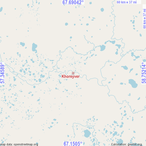
Khoreyver GPS coordinates[2]
67° 25' 19.164" North, 58° 2' 56.436" East
| Map corner | latitude | longitude |
|---|---|---|
| Upper-left | 67.69042°, | 57.34589° |
| Center: | 67.42199°, | 58.04901° |
| Lower-right: | 67.1505°, | 58.75214° |
| Map W x H: | 60×60 km | = 37.3×37.3mi |
| max Lat: | 73.50819° ⇑1.4% North |
| Khoreyver: | 67.42199° |
| min Lat: | ⇓98.6% South 41.28413° |
| min Long | Khoreyver | max Long |
| -179.12198° | 58.04901° | 179.35046° |
| W 69.6%⇐ | ⇒30.4% E |
Elevation
Elevation of Khoreyver is 84 m = 276 ft, and this is 118.6 m = 389 ft below average elevation for this country.
| Max E: |
2518 m = 8261 ft | 76.1% |
| Avg. | 202.6 m = 665 ft | |
| Khoreyver | 84 m = 276 ft | |
Min E: |
-28 m = -92 ft | 23.9% |
See also: Russia elevation on elevation.city.
Geographical zone
Khoreyver is located in North Frigid zone (between North Pole and Arctic Circle). Distance of this North polar circle is 95.4 km =59.3 mi to South.| Distance of | km | miles | from Khoreyver |
|---|---|---|---|
| North Pole | 2510.4 | 1559.9 | to North |
| Arctic Circle | 95.4 | 59.3 | to South |
| Tropic Cancer | 4890.7 | 3038.9 | to South |
| Equator | 7496.6 | 4658.2 | to South |


Nearby cities:
9 places around Khoreyver: (largest is in red/bold)
• Inta
180.4 km =112.1 mi,  148°
148°
• Kozhva
261.3 km =162.4 mi,  189°
189°
• Parma
158.9 km =98.7 mi, 185°
• Pechora
255.6 km =158.8 mi, 188°
• Puteyets
253.9 km =157.8 mi, 189°
• Synya
228 km =141.7 mi,  180°
180°
• Usinsk
160.4 km =99.7 mi, 188°
• Verkhnyaya Inta
188.5 km =117.1 mi, 148°
• Vuktyl
397.9 km =247.2 mi, 184°
Sources, notices
• [Note1] Compared only with cities in Russia existing in our database
• [Src1] Map data: © OpenStreetMap contributors (CC-BY-SA)
• [Src2] Other city data from geonames.org with taken over terms of usage.
• [Src3] Geographical zone / Annual Mean Temperature by Robert A. Rohde @ Wikipedia
