Bavtugay geodata
Bavtugay (Dagestan) is a populated place; located in Russia in Europe/Moscow (GMT+3) time zone. With population of 5,398 people, there are 2474 cities with bigger population in this country. Compared to other cities in Russia, 96.6% of cities are located further ↑North; 55.4% of cities are located further ←West and 68.8% of cities have higher elevation than Bavtugay. Note1


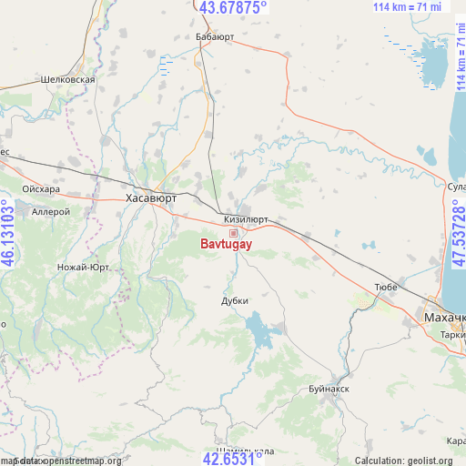
Bavtugay GPS coordinates[2]
43° 10' 5.088" North, 46° 50' 2.94" East
| Map corner | latitude | longitude |
|---|---|---|
| Upper-left | 43.67875°, | 46.13103° |
| Center: | 43.16808°, | 46.83415° |
| Lower-right: | 42.6531°, | 47.53728° |
| Map W x H: | 114×114 km | = 70.8×70.8mi |
| max Lat: | 73.50819° ⇑96.6% North |
| Bavtugay: | 43.16808° |
| min Lat: | ⇓3.4% South 41.28413° |
| min Long | Bavtugay | max Long |
| -179.12198° | 46.83415° | 179.35046° |
| W 55.4%⇐ | ⇒44.6% E |
Elevation
Elevation of Bavtugay is 105 m = 344 ft, and this is 97.6 m = 320 ft below average elevation for this country.
| Max E: |
2518 m = 8261 ft | 68.8% |
| Avg. | 202.6 m = 665 ft | |
| Bavtugay | 105 m = 344 ft | |
Min E: |
-28 m = -92 ft | 31.2% |
See also: Russia elevation on elevation.city.
Geographical zone
Bavtugay is located in North temperate zone (between Tropic of Cancer and the Arctic Circle). Distance of this Northern Tropic circle is 2193.9 km =1363.2 mi to South.| Distance of | km | miles | from Bavtugay |
|---|---|---|---|
| North Pole | 5207.2 | 3235.6 | to North |
| Arctic Circle | 2601.3 | 1616.4 | to North |
| Tropic Cancer | 2193.9 | 1363.2 | to South |
| Equator | 4799.8 | 2982.5 | to South |


Nearby cities:
15 places around Bavtugay: (largest is in red/bold)
• Chontaul
15.3 km =9.5 mi,  7°
7°
• Dubki
16.3 km =10.1 mi,  179°
179°
• Dylym
19.5 km =12.1 mi,  236°
236°
• Endirey
14.6 km =9.1 mi,  267°
267°
• Kizilyurt
4.7 km =2.9 mi,  61°
61°
• Kokrek
11.6 km =7.2 mi,  311°
311°
• Kostek
19.6 km =12.2 mi,  4°
4°
• Miatli
9.6 km =6 mi, 182°
• Mutsalaul
14.6 km =9.1 mi,  324°
324°
• Novyy Chirkey
18 km =11.2 mi,  92°
92°
• Novyy Kostek
18.6 km =11.6 mi,  357°
357°
• Novyy Sulak
1.6 km =1 mi,  336°
336°
• Pokrovskoye
19.2 km =11.9 mi, 314°
• Temiraul
9.5 km =5.9 mi, 355°
• Zubutli-Miatli
3.8 km =2.4 mi,  332°
332°
Sources, notices
• [Note1] Compared only with cities in Russia existing in our database
• [Src1] Map data: © OpenStreetMap contributors (CC-BY-SA)
• [Src2] Other city data from geonames.org with taken over terms of usage.
• [Src3] Geographical zone / Annual Mean Temperature by Robert A. Rohde @ Wikipedia
