Poletayevo geodata
Poletayevo (Chelyabinsk) is a populated place; located in Russia in Asia/Yekaterinburg (GMT+5) time zone. With population of 6,532 people, there are 2117 cities with bigger population in this country. Compared to other cities in Russia, 53.7% of cities are located further ↓South; 73.4% of cities are located further ←West and 79.5% of cities have lower elevation than Poletayevo. Note1


Poletayevo GPS coordinates[2]
55° 2' 0.96" North, 61° 6' 49.68" East
| Map corner | latitude | longitude |
|---|---|---|
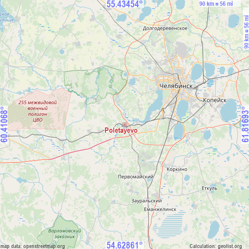
| Upper-left | 55.43454°, | 60.41068° |
| Center: | 55.0336°, | 61.1138° |
| Lower-right: | 54.62861°, | 61.81693° |
| Map W x H: | 89.6×89.6 km | = 55.7×55.7mi |
| max Lat: | 73.50819° ⇑46.3% North |
| Poletayevo: | 55.0336° |
| min Lat: | ⇓53.7% South 41.28413° |
| min Long | Poletayevo | max Long |
| -179.12198° | 61.1138° | 179.35046° |
| W 73.4%⇐ | ⇒26.6% E |
Elevation
Elevation of Poletayevo is 244 m = 801 ft, and this is 41.4 m = 136 ft above average elevation for this country.
| Max E: |
2518 m = 8261 ft | 20.5% |
| Poletayevo | 244 m 801 ft | |
| Avg. | 202.6 m = 665 ft | |
Min E: |
-28 m = -92 ft | 79.5% |
See also: Russia elevation on elevation.city.
Geographical zone
Poletayevo is located in North temperate zone (between Tropic of Cancer and the Arctic Circle). Distance of this North polar circle is 1282 km =796.6 mi to North.| Distance of | km | miles | from Poletayevo |
|---|---|---|---|
| North Pole | 3887.9 | 2415.8 | to North |
| Arctic Circle | 1282 | 796.6 | to North |
| Tropic Cancer | 3513.2 | 2183 | to South |
| Equator | 6119.2 | 3802.3 | to South |


Nearby cities:
15 places around Poletayevo: (largest is in red/bold)
• Bazhovo
31.4 km =19.5 mi,  84°
84°
• Chelyabinsk
24.1 km =15 mi,  56°
56°
• Dolgoderevenskoye
37.5 km =23.3 mi,  22°
22°
• Kopeysk
34 km =21.1 mi,  74°
74°
• Korkino
24 km =14.9 mi,  131°
131°
• Novosineglazovskiy
16.8 km =10.4 mi,  87°
87°
• Potanino
36.1 km =22.4 mi, 63°
• Roshchino
32.2 km =20 mi, 17°
• Roza
25.6 km =15.9 mi,  120°
120°
• Sargazy
8.8 km =5.5 mi,  99°
99°
• Starokamyshinsk
30.2 km =18.8 mi, 88°
• Timiryazevskiy
25.2 km =15.7 mi,  242°
242°
• Yemanzhelinka
28.4 km =17.6 mi,  155°
155°
• Yemanzhelinsk
33.7 km =20.9 mi, 156°
• Zheleznodorozhnyy
28.7 km =17.8 mi, 74°
Sources, notices
• [Note1] Compared only with cities in Russia existing in our database
• [Src1] Map data: © OpenStreetMap contributors (CC-BY-SA)
• [Src2] Other city data from geonames.org with taken over terms of usage.
• [Src3] Geographical zone / Annual Mean Temperature by Robert A. Rohde @ Wikipedia
