Izumrud geodata
Izumrud (Sverdlovsk) is a populated place; located in Russia in Asia/Yekaterinburg (GMT+5) time zone. With population of 1,307 people, there are 4468 cities with bigger population in this country. Compared to other cities in Russia, 77.9% of cities are located further ↓South; 73.7% of cities are located further ←West and 76.9% of cities have lower elevation than Izumrud. Note1


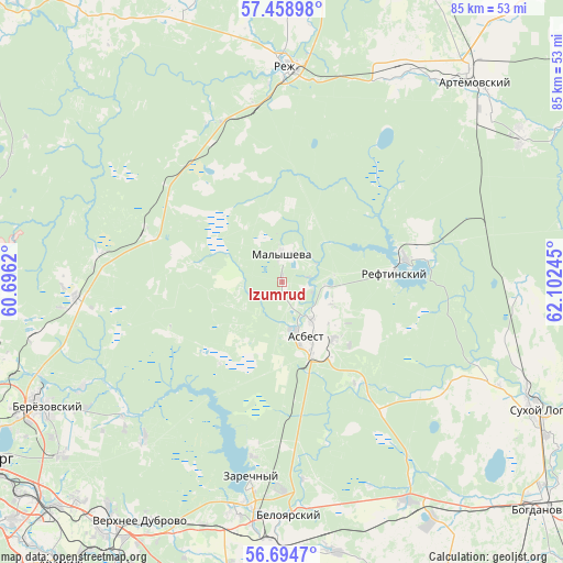
Izumrud GPS coordinates[2]
57° 4' 43.716" North, 61° 23' 57.552" East
| Map corner | latitude | longitude |
|---|---|---|
| Upper-left | 57.45898°, | 60.6962° |
| Center: | 57.07881°, | 61.39932° |
| Lower-right: | 56.6947°, | 62.10245° |
| Map W x H: | 85×85 km | = 52.8×52.8mi |
| max Lat: | 73.50819° ⇑22.1% North |
| Izumrud: | 57.07881° |
| min Lat: | ⇓77.9% South 41.28413° |
| min Long | Izumrud | max Long |
| -179.12198° | 61.39932° | 179.35046° |
| W 73.7%⇐ | ⇒26.3% E |
Elevation
Elevation of Izumrud is 226 m = 741 ft, and this is 23.4 m = 77 ft above average elevation for this country.
| Max E: |
2518 m = 8261 ft | 23.1% |
| Izumrud | 226 m 741 ft | |
| Avg. | 202.6 m = 665 ft | |
Min E: |
-28 m = -92 ft | 76.9% |
See also: Russia elevation on elevation.city.
Geographical zone
Izumrud is located in North temperate zone (between Tropic of Cancer and the Arctic Circle). Distance of this North polar circle is 1054.6 km =655.3 mi to North.| Distance of | km | miles | from Izumrud |
|---|---|---|---|
| North Pole | 3660.5 | 2274.5 | to North |
| Arctic Circle | 1054.6 | 655.3 | to North |
| Tropic Cancer | 3740.6 | 2324.3 | to South |
| Equator | 6346.6 | 3943.6 | to South |


Nearby cities:
15 places around Izumrud: (largest is in red/bold)
• Artëmovskiy
41.8 km =26 mi,  42°
42°
• Asbest
8.4 km =5.2 mi,  155°
155°
• Beloyarskiy
35.6 km =22.1 mi,  178°
178°
• Beryozovsky
40.9 km =25.4 mi,  242°
242°
• Gryaznovskoye
37.8 km =23.5 mi,  150°
150°
• Klyuchevsk
28.1 km =17.5 mi,  279°
279°
• Losinyy
21.2 km =13.2 mi,  288°
288°
• Malysheva
4.4 km =2.7 mi,  3°
3°
• Monetnyy
31.6 km =19.6 mi,  263°
263°
• Reftinskiy
16.8 km =10.4 mi,  85°
85°
• Rezh
32.4 km =20.1 mi, 0°
• Sarapulka
31.4 km =19.5 mi,  221°
221°
• Staropyshminsk
33.9 km =21.1 mi, 242°
• Verkhneye Dubrovo
42.1 km =26.2 mi,  210°
210°
• Zarechnyy
30.1 km =18.7 mi,  188°
188°
Sources, notices
• [Note1] Compared only with cities in Russia existing in our database
• [Src1] Map data: © OpenStreetMap contributors (CC-BY-SA)
• [Src2] Other city data from geonames.org with taken over terms of usage.
• [Src3] Geographical zone / Annual Mean Temperature by Robert A. Rohde @ Wikipedia
