Longwood geodata
Longwood (Saint Helena) is a populated place; located in Saint Helena in Atlantic/St_Helena (GMT+0) time zone. With population of 701 people, there is 1 city with bigger population in this country. Compared to other cities in Saint Helena, 75% of cities are located further ↑North; 100% of cities are located further ←West and 100% of cities have lower elevation than Longwood. Note1


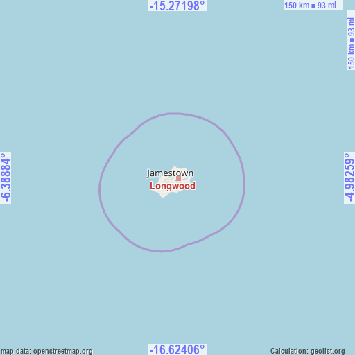
Longwood GPS coordinates[2]
15° 56' 56.976" South, 5° 41' 8.556" West
| Map corner | latitude | longitude |
|---|---|---|
| Upper-left | -15.27198°, | -6.38884° |
| Center: | -15.94916°, | -5.68571° |
| Lower-right: | -16.62406°, | -4.98259° |
| Map W x H: | 150.3×150.3 km | = 93.4×93.4mi |
| max Lat: | -7.92861° ⇑75% North |
| Longwood: | -15.94916° |
| min Lat: | ⇓25% South -37.06757° |
| min Long | Longwood | max Long |
| -14.41194° | -5.68571° | -5.68571° |
| W 100%⇐ | ⇒0% E |
Elevation
Elevation of Longwood is 526 m = 1726 ft, and this is 251 m = 823 ft above average elevation for this country.
| Max E: |
526 m = 1726 ft | 0% |
| Longwood | 526 m 1726 ft | |
| Avg. | 275 m = 902 ft | |
Min E: |
20 m = 66 ft | 100% |
See also: Saint Helena elevation on elevation.city.
Geographical zone
Longwood is located in South Torrid zone (between Equator and Tropic of Capricorn). Distance of this Southern Tropic circle is 832.5 km =517.3 mi to South.| Distance of | km | miles | from Longwood |
|---|---|---|---|
| Equator | 1773.4 | 1101.9 | to North |
| Tropic Capricorn | 832.5 | 517.3 | to South |
| Antarctic Circle | 5627.8 | 3497 | to South |
| South Pole | 8233.7 | 5116.2 | to South |


Nearby cities:
2 places around Longwood: (largest is in red/bold)
• Half Tree Hollow
3.9 km =2.4 mi,  289°
289°
• Jamestown
3.5 km =2.2 mi, 289°
Sources, notices
• [Note1] Compared only with cities in Saint Helena existing in our database
• [Src1] Map data: © OpenStreetMap contributors (CC-BY-SA)
• [Src2] Other city data from geonames.org with taken over terms of usage.
• [Src3] Geographical zone / Annual Mean Temperature by Robert A. Rohde @ Wikipedia
