Limbuš geodata
Limbuš (Maribor) is a populated place; located in Slovenia in Europe/Ljubljana (GMT+2) time zone. With population of 2,040 people, there are 99 cities with bigger population in this country. Compared to other cities in Slovenia, 85.2% of cities are located further ↓South; 71.7% of cities are located further ←West and 50.5% of cities have lower elevation than Limbuš. Note1


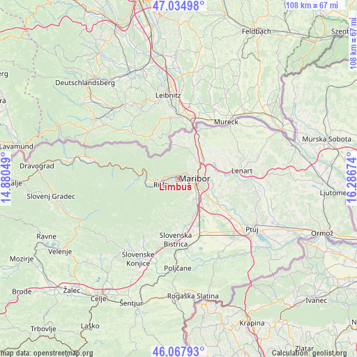
Limbuš GPS coordinates[2]
46° 33' 12.996" North, 15° 35' 0.996" East
| Map corner | latitude | longitude |
|---|---|---|
| Upper-left | 47.03498°, | 14.88049° |
| Center: | 46.55361°, | 15.58361° |
| Lower-right: | 46.06793°, | 16.28674° |
| Map W x H: | 107.5×107.5 km | = 66.8×66.8mi |
| max Lat: | 46.83694° ⇑14.8% North |
| Limbuš: | 46.55361° |
| min Lat: | ⇓85.2% South 45.47667° |
| min Long | Limbuš | max Long |
| 13.52639° | 15.58361° | 16.4975° |
| W 71.7%⇐ | ⇒28.3% E |
Elevation
Elevation of Limbuš is 297 m = 974 ft, and this is 28.6 m = 94 ft below average elevation for this country.
| Max E: |
1551 m = 5089 ft | 49.5% |
| Avg. | 325.6 m = 1068 ft | |
| Limbuš | 297 m = 974 ft | |
Min E: |
2 m = 7 ft | 50.5% |
See also: Slovenia elevation on elevation.city.
Geographical zone
Limbuš is located in North temperate zone (between Tropic of Cancer and the Arctic Circle). Distance of this North polar circle is 2224.9 km =1382.5 mi to North.| Distance of | km | miles | from Limbuš |
|---|---|---|---|
| North Pole | 4830.8 | 3001.7 | to North |
| Arctic Circle | 2224.9 | 1382.5 | to North |
| Tropic Cancer | 2570.4 | 1597.2 | to South |
| Equator | 5176.3 | 3216.4 | to South |


Nearby cities:
15 places around Limbuš: (largest is in red/bold)
• Bezena
3.9 km =2.4 mi,  260°
260°
• Bistrica ob Dravi
2.7 km =1.7 mi,  271°
271°
• Bresternica
1.9 km =1.2 mi,  339°
339°
• Hrastje
2.6 km =1.6 mi,  197°
197°
• Kamnica
3.3 km =2.1 mi,  45°
45°
• Kozjak nad Pesnico
7.4 km =4.6 mi,  31°
31°
• Maribor
4.8 km =3 mi,  88°
88°
• Pekre
1.2 km =0.7 mi,  127°
127°
• Pivola
6.4 km =4 mi,  153°
153°
• Razvanje
5.9 km =3.7 mi,  137°
137°
• Ruše
5.4 km =3.4 mi,  253°
253°
• Selnica ob Dravi
6.8 km =4.2 mi, 266°
• Spodnje Hoče
7.8 km =4.8 mi, 139°
• Spodnji Slemen
4.1 km =2.5 mi,  290°
290°
• Zgornje Hoče
7.5 km =4.7 mi,  156°
156°
Sources, notices
• [Note1] Compared only with cities in Slovenia existing in our database
• [Src1] Map data: © OpenStreetMap contributors (CC-BY-SA)
• [Src2] Other city data from geonames.org with taken over terms of usage.
• [Src3] Geographical zone / Annual Mean Temperature by Robert A. Rohde @ Wikipedia
