Nukunonu geodata
Nukunonu is a seat of a first-order administrative division; located in Tokelau in Pacific/Fakaofo (GMT+13) time zone. With population of 426 people, there is 1 city with bigger population in this country. Compared to other cities in Tokelau, 50% of cities are located further ↓South; 50% of cities are located further ←West and 50% of cities have lower elevation than Nukunonu. Note1


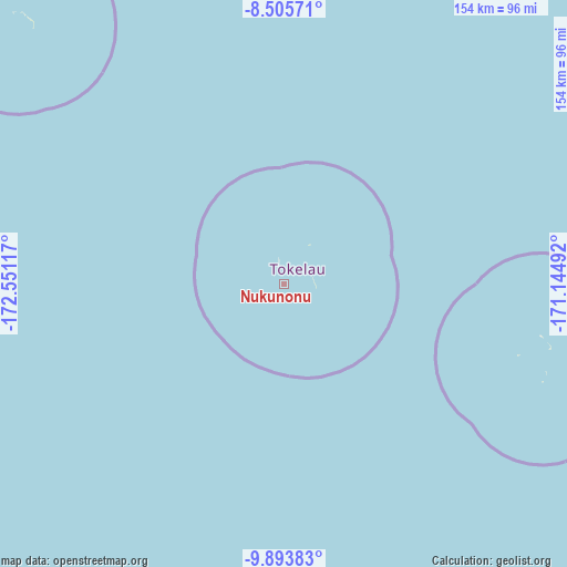
Nukunonu GPS coordinates[2]
9° 12' 1.62" South, 171° 50' 52.944" West
| Map corner | latitude | longitude |
|---|---|---|
| Upper-left | -8.50571°, | -172.55117° |
| Center: | -9.20045°, | -171.84804° |
| Lower-right: | -9.89383°, | -171.14492° |
| Map W x H: | 154.3×154.3 km | = 95.9×95.9mi |
| max Lat: | -8.54212° ⇑50% North |
| Nukunonu: | -9.20045° |
| min Lat: | ⇓50% South -9.38516° |
| min Long | Nukunonu | max Long |
| -172.51591° | -171.84804° | -171.24675° |
| W 50%⇐ | ⇒50% E |
Elevation
Elevation of Nukunonu is 10 m = 33 ft, and this is 1 m = 3 ft above average elevation for this country.
| Max E: |
10 m = 33 ft | 50% |
| Nukunonu | 10 m 33 ft | |
| Avg. | 9 m = 30 ft | |
Min E: |
7 m = 23 ft | 50% |
See also: Tokelau elevation on elevation.city.
Geographical zone
Nukunonu is located in South Torrid zone (between Equator and Tropic of Capricorn). Distance of Equator is 1023 km =635.7 mi to North.| Distance of | km | miles | from Nukunonu |
|---|---|---|---|
| Equator | 1023 | 635.7 | to North |
| Tropic Capricorn | 1582.9 | 983.6 | to South |
| Antarctic Circle | 6378.2 | 3963.2 | to South |
| South Pole | 8984.1 | 5582.5 | to South |


Nearby cities:
2 places around Nukunonu: (largest is in red/bold)
• Atafu Village
103.6 km =64.4 mi,  314°
314°
• Fale old settlement
69.1 km =42.9 mi,  107°
107°
Sources, notices
• [Note1] Compared only with cities in Tokelau existing in our database
• [Src1] Map data: © OpenStreetMap contributors (CC-BY-SA)
• [Src2] Other city data from geonames.org with taken over terms of usage.
• [Src3] Geographical zone / Annual Mean Temperature by Robert A. Rohde @ Wikipedia
