Yavşan geodata
Yavşan (Şırnak) is a populated place; located in Turkey in Europe/Istanbul (GMT+3) time zone. With population of 869 people, there are 1127 cities with bigger population in this country. Compared to other cities in Turkey, 83.3% of cities are located further ↑North; 90.4% of cities are located further ←West and 54.4% of cities have higher elevation than Yavşan. Note1


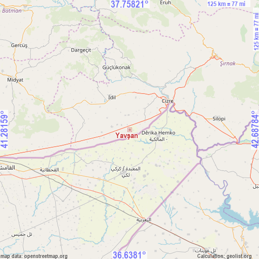
Yavşan GPS coordinates[2]
37° 12' 0.828" North, 41° 59' 4.956" East
| Map corner | latitude | longitude |
|---|---|---|
| Upper-left | 37.75821°, | 41.28159° |
| Center: | 37.20023°, | 41.98471° |
| Lower-right: | 36.6381°, | 42.68784° |
| Map W x H: | 124.5×124.5 km | = 77.4×77.4mi |
| max Lat: | 42.02683° ⇑83.3% North |
| Yavşan: | 37.20023° |
| min Lat: | ⇓16.7% South 35.9025° |
| min Long | Yavşan | max Long |
| 25.90902° | 41.98471° | 44.60099° |
| W 90.4%⇐ | ⇒9.6% E |
Elevation
Elevation of Yavşan is 606 m = 1988 ft, and this is 111.4 m = 365 ft below average elevation for this country.
| Max E: |
2682 m = 8799 ft | 54.4% |
| Avg. | 717.4 m = 2354 ft | |
| Yavşan | 606 m = 1988 ft | |
Min E: |
0 m = 0 ft | 45.6% |
See also: Turkey elevation on elevation.city.
Geographical zone
Yavşan is located in North temperate zone (between Tropic of Cancer and the Arctic Circle). Distance of this Northern Tropic circle is 1530.4 km =950.9 mi to South.| Distance of | km | miles | from Yavşan |
|---|---|---|---|
| North Pole | 5870.8 | 3647.9 | to North |
| Arctic Circle | 3264.9 | 2028.7 | to North |
| Tropic Cancer | 1530.4 | 950.9 | to South |
| Equator | 4136.3 | 2570.2 | to South |


Nearby cities:
15 places around Yavşan: (largest is in red/bold)
• Alakamış
17.9 km =11.1 mi,  255°
255°
• Barim
9.3 km =5.8 mi,  333°
333°
• Cibri
13.1 km =8.1 mi,  50°
50°
• Dicle
12.3 km =7.6 mi,  36°
36°
• Duruköy
6.6 km =4.1 mi,  294°
294°
• Katran
12.5 km =7.8 mi,  62°
62°
• Korucu
7.5 km =4.7 mi, 60°
• Köyceğiz
9.7 km =6 mi, 255°
• Ortaköy
4.6 km =2.9 mi,  299°
299°
• Oymak
12.3 km =7.6 mi, 298°
• Ozan
7 km =4.3 mi,  355°
355°
• Pınarbaşı
8.8 km =5.5 mi,  279°
279°
• Sulak
17 km =10.6 mi, 51°
• Varımlı
13.4 km =8.3 mi, 264°
• İdil
17.2 km =10.7 mi, 330°
Sources, notices
• [Note1] Compared only with cities in Turkey existing in our database
• [Src1] Map data: © OpenStreetMap contributors (CC-BY-SA)
• [Src2] Other city data from geonames.org with taken over terms of usage.
• [Src3] Geographical zone / Annual Mean Temperature by Robert A. Rohde @ Wikipedia
