Jackson geodata
Jackson (Alabama) is a populated place; located in United States in America/Chicago (GMT-5) time zone. With population of 4,967 people, there are 7212 cities with bigger population in this country. Compared to other cities in United States, 89.6% of cities are located further ↑North; 52.4% of cities are located further →East and 75.5% of cities have higher elevation than Jackson. Note1


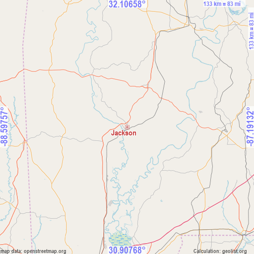
Jackson GPS coordinates[2]
31° 30' 32.58" North, 87° 53' 39.984" West
| Map corner | latitude | longitude |
|---|---|---|
| Upper-left | 32.10658°, | -88.59757° |
| Center: | 31.50905°, | -87.89444° |
| Lower-right: | 30.90768°, | -87.19132° |
| Map W x H: | 133.3×133.3 km | = 82.8×82.8mi |
| max Lat: | 71.29058° ⇑89.6% North |
| Jackson: | 31.50905° |
| min Lat: | ⇓10.4% South 19.06759° |
| min Long | Jackson | max Long |
| -171.73463° | -87.89444° | -66.98998° |
| W 47.6%⇐ | ⇒52.4% E |
Elevation
Elevation of Jackson is 69 m = 226 ft, and this is 225.8 m = 741 ft below average elevation for this country.
| Max E: |
3189 m = 10463 ft | 75.5% |
| Avg. | 294.8 m = 967 ft | |
| Jackson | 69 m = 226 ft | |
Min E: |
-60 m = -197 ft | 24.5% |
See also: United States elevation on elevation.city.
Geographical zone
Jackson is located in North temperate zone (between Tropic of Cancer and the Arctic Circle). Distance of this Northern Tropic circle is 897.6 km =557.7 mi to South.| Distance of | km | miles | from Jackson |
|---|---|---|---|
| North Pole | 6503.6 | 4041.1 | to North |
| Arctic Circle | 3897.7 | 2421.9 | to North |
| Tropic Cancer | 897.6 | 557.7 | to South |
| Equator | 3503.5 | 2177 | to South |


Nearby cities:
15 places around Jackson: (largest is in red/bold)
• Axis
65.6 km =40.8 mi,  191°
191°
• Belmont
56.3 km =35 mi,  276°
276°
• Buckatunna
60.2 km =37.4 mi,  273°
273°
• Chatom
34.5 km =21.4 mi,  261°
261°
• Citronelle
56.3 km =35 mi,  214°
214°
• Excel
53.2 km =33.1 mi,  99°
99°
• Frisco City
47.5 km =29.5 mi, 100°
• Grove Hill
24.8 km =15.4 mi,  26°
26°
• Leroy
8.6 km =5.3 mi, 266°
• Millry
42 km =26.1 mi,  289°
289°
• Monroeville
54 km =33.6 mi,  87°
87°
• Mount Vernon
48.5 km =30.1 mi, 193°
• Pine Hill
59.8 km =37.2 mi, 28°
• State Line
55.6 km =34.5 mi, 261°
• Thomasville
47.4 km =29.5 mi,  18°
18°
Sources, notices
• [Note1] Compared only with cities in United States existing in our database
• [Src1] Map data: © OpenStreetMap contributors (CC-BY-SA)
• [Src2] Other city data from geonames.org with taken over terms of usage.
• [Src3] Geographical zone / Annual Mean Temperature by Robert A. Rohde @ Wikipedia
