Ash Flat geodata
Ash Flat (Arkansas) is a seat of a second-order administrative division; located in United States in America/Chicago (GMT-5) time zone. With population of 1,064 people, there are 15874 cities with bigger population in this country. Compared to other cities in United States, 69.3% of cities are located further ↑North; 63.3% of cities are located further →East and 51.2% of cities have lower elevation than Ash Flat. Note1


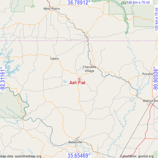
Ash Flat GPS coordinates[2]
36° 13' 26.256" North, 91° 36' 30.528" West
| Map corner | latitude | longitude |
|---|---|---|
| Upper-left | 36.78912°, | -92.31161° |
| Center: | 36.22396°, | -91.60848° |
| Lower-right: | 35.65469°, | -90.90536° |
| Map W x H: | 126.1×126.1 km | = 78.4×78.4mi |
| max Lat: | 71.29058° ⇑69.3% North |
| Ash Flat: | 36.22396° |
| min Lat: | ⇓30.7% South 19.06759° |
| min Long | Ash Flat | max Long |
| -171.73463° | -91.60848° | -66.98998° |
| W 36.7%⇐ | ⇒63.3% E |
Elevation
Elevation of Ash Flat is 203 m = 666 ft, and this is 91.8 m = 301 ft below average elevation for this country.
| Max E: |
3189 m = 10463 ft | 48.8% |
| Avg. | 294.8 m = 967 ft | |
| Ash Flat | 203 m = 666 ft | |
Min E: |
-60 m = -197 ft | 51.2% |
See also: United States elevation on elevation.city.
Geographical zone
Ash Flat is located in North temperate zone (between Tropic of Cancer and the Arctic Circle). Distance of this Northern Tropic circle is 1421.8 km =883.5 mi to South.| Distance of | km | miles | from Ash Flat |
|---|---|---|---|
| North Pole | 5979.3 | 3715.4 | to North |
| Arctic Circle | 3373.4 | 2096.1 | to North |
| Tropic Cancer | 1421.8 | 883.5 | to South |
| Equator | 4027.7 | 2502.7 | to South |


Nearby cities:
15 places around Ash Flat: (largest is in red/bold)
• Alton
55.5 km =34.5 mi,  19°
19°
• Batesville
50.6 km =31.4 mi,  183°
183°
• Black Rock
47.6 km =29.6 mi,  105°
105°
• Calico Rock
48.8 km =30.3 mi,  256°
256°
• Cave City
31.8 km =19.8 mi,  170°
170°
• Cherokee Village
11.7 km =7.3 mi,  45°
45°
• Hardy
15.2 km =9.4 mi, 47°
• Highland
9.5 km =5.9 mi, 52°
• Horseshoe Bend
14 km =8.7 mi,  272°
272°
• Imboden
39 km =24.2 mi,  93°
93°
• Mammoth Spring
30.8 km =19.1 mi,  11°
11°
• Melbourne
32.6 km =20.3 mi,  235°
235°
• Oxford
28.8 km =17.9 mi, 269°
• Salem
25.2 km =15.7 mi,  310°
310°
• Thayer
34 km =21.1 mi, 10°
Sources, notices
• [Note1] Compared only with cities in United States existing in our database
• [Src1] Map data: © OpenStreetMap contributors (CC-BY-SA)
• [Src2] Other city data from geonames.org with taken over terms of usage.
• [Src3] Geographical zone / Annual Mean Temperature by Robert A. Rohde @ Wikipedia
