Indiantown geodata
Indiantown (Florida) is a populated place; located in United States in America/New_York (GMT-4) time zone. With population of 6,083 people, there are 6348 cities with bigger population in this country. Compared to other cities in United States, 97.6% of cities are located further ↑North; 70.9% of cities are located further ←West and 90% of cities have higher elevation than Indiantown. Note1


Indiantown GPS coordinates[2]
27° 1' 38.208" North, 80° 29' 8.196" West
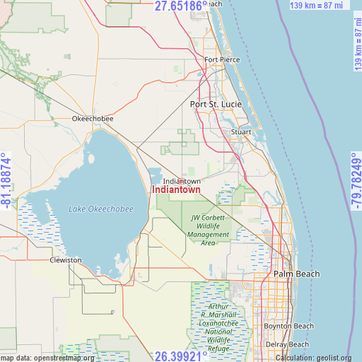
| Map corner | latitude | longitude |
|---|---|---|
| Upper-left | 27.65186°, | -81.18874° |
| Center: | 27.02728°, | -80.48561° |
| Lower-right: | 26.39921°, | -79.78249° |
| Map W x H: | 139.3×139.3 km | = 86.6×86.6mi |
| max Lat: | 71.29058° ⇑97.6% North |
| Indiantown: | 27.02728° |
| min Lat: | ⇓2.4% South 19.06759° |
| min Long | Indiantown | max Long |
| -171.73463° | -80.48561° | -66.98998° |
| W 70.9%⇐ | ⇒29.1% E |
Elevation
Elevation of Indiantown is 16 m = 52 ft, and this is 278.8 m = 915 ft below average elevation for this country.
| Max E: |
3189 m = 10463 ft | 90% |
| Avg. | 294.8 m = 967 ft | |
| Indiantown | 16 m = 52 ft | |
Min E: |
-60 m = -197 ft | 10% |
See also: United States elevation on elevation.city.
Geographical zone
Indiantown is located in North temperate zone (between Tropic of Cancer and the Arctic Circle). Distance of this Northern Tropic circle is 399.2 km =248.1 mi to South.| Distance of | km | miles | from Indiantown |
|---|---|---|---|
| North Pole | 7001.9 | 4350.8 | to North |
| Arctic Circle | 4396 | 2731.5 | to North |
| Tropic Cancer | 399.2 | 248.1 | to South |
| Equator | 3005.2 | 1867.3 | to South |


Nearby cities:
15 places around Indiantown: (largest is in red/bold)
• Hobe Sound
34.8 km =21.6 mi,  84°
84°
• Jensen Beach
35.8 km =22.2 mi,  45°
45°
• Limestone Creek
35.4 km =22 mi,  105°
105°
• North River Shores
30.1 km =18.7 mi, 45°
• Pahokee
29.1 km =18.1 mi,  217°
217°
• Palm City
26.8 km =16.7 mi, 54°
• Port Saint Lucie
32.5 km =20.2 mi,  24°
24°
• Port Salerno
31.1 km =19.3 mi,  65°
65°
• Rio
32.4 km =20.1 mi, 48°
• River Park
34.7 km =21.6 mi, 23°
• Sewall's Point
34 km =21.1 mi,  55°
55°
• Stuart
29.8 km =18.5 mi, 50°
• Taylor Creek
36.7 km =22.8 mi,  305°
305°
• Tequesta
36 km =22.4 mi,  100°
100°
• The Acreage
33.8 km =21 mi,  140°
140°
Sources, notices
• [Note1] Compared only with cities in United States existing in our database
• [Src1] Map data: © OpenStreetMap contributors (CC-BY-SA)
• [Src2] Other city data from geonames.org with taken over terms of usage.
• [Src3] Geographical zone / Annual Mean Temperature by Robert A. Rohde @ Wikipedia
