Jasmine Estates geodata
Jasmine Estates (Florida) is a populated place; located in United States in America/New_York (GMT-4) time zone. With population of 18,989 people, there are 2655 cities with bigger population in this country. Compared to other cities in United States, 96.2% of cities are located further ↑North; 63% of cities are located further ←West and 94.8% of cities have higher elevation than Jasmine Estates. Note1


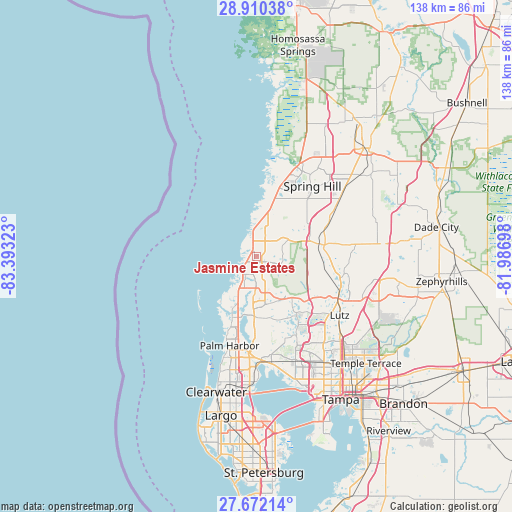
Jasmine Estates GPS coordinates[2]
28° 17' 35.016" North, 82° 41' 24.36" West
| Map corner | latitude | longitude |
|---|---|---|
| Upper-left | 28.91038°, | -83.39323° |
| Center: | 28.29306°, | -82.6901° |
| Lower-right: | 27.67214°, | -81.98698° |
| Map W x H: | 137.7×137.7 km | = 85.6×85.6mi |
| max Lat: | 71.29058° ⇑96.2% North |
| Jasmine Estates: | 28.29306° |
| min Lat: | ⇓3.8% South 19.06759° |
| min Long | Jasmine Estates | max Long |
| -171.73463° | -82.6901° | -66.98998° |
| W 63%⇐ | ⇒37% E |
Elevation
Elevation of Jasmine Estates is 9 m = 30 ft, and this is 285.8 m = 938 ft below average elevation for this country.
| Max E: |
3189 m = 10463 ft | 94.8% |
| Avg. | 294.8 m = 967 ft | |
| Jasmine Estates | 9 m = 30 ft | |
Min E: |
-60 m = -197 ft | 5.2% |
See also: United States elevation on elevation.city.
Geographical zone
Jasmine Estates is located in North temperate zone (between Tropic of Cancer and the Arctic Circle). Distance of this Northern Tropic circle is 540 km =335.5 mi to South.| Distance of | km | miles | from Jasmine Estates |
|---|---|---|---|
| North Pole | 6861.2 | 4263.4 | to North |
| Arctic Circle | 4255.3 | 2644.1 | to North |
| Tropic Cancer | 540 | 335.5 | to South |
| Equator | 3145.9 | 1954.8 | to South |


Nearby cities:
15 places around Jasmine Estates: (largest is in red/bold)
• Bayonet Point
3.8 km =2.4 mi,  9°
9°
• Beacon Square
11.4 km =7.1 mi,  214°
214°
• Elfers
9.1 km =5.7 mi,  200°
200°
• Heritage Pines
16.2 km =10.1 mi,  24°
24°
• Holiday
12.7 km =7.9 mi, 202°
• Hudson
7.9 km =4.9 mi,  357°
357°
• Key Vista
13.5 km =8.4 mi,  215°
215°
• Keystone
16.7 km =10.4 mi,  156°
156°
• Meadow Oaks
10.4 km =6.5 mi,  55°
55°
• New Port Richey
6.1 km =3.8 mi, 207°
• New Port Richey East
3.7 km =2.3 mi,  183°
183°
• Odessa
14.6 km =9.1 mi,  138°
138°
• Port Richey
3.7 km =2.3 mi,  230°
230°
• Quail Ridge
14.6 km =9.1 mi, 64°
• Trinity
12.5 km =7.8 mi, 176°
Sources, notices
• [Note1] Compared only with cities in United States existing in our database
• [Src1] Map data: © OpenStreetMap contributors (CC-BY-SA)
• [Src2] Other city data from geonames.org with taken over terms of usage.
• [Src3] Geographical zone / Annual Mean Temperature by Robert A. Rohde @ Wikipedia
