Plantation Mobile Home Park geodata
Plantation Mobile Home Park (Florida) is a section of populated place; located in United States in America/New_York (GMT-4) time zone. With population of 1,260 people, there are 14793 cities with bigger population in this country. Compared to other cities in United States, 97.8% of cities are located further ↑North; 72.6% of cities are located further ←West and 93% of cities have higher elevation than Plantation Mobile Home Park. Note1
Current local time in Plantation Mobile Home Park:
05:02 AM, FridayDifference from your time zone: hours


Plantation Mobile Home Park GPS coordinates[2]
26° 42' 11.232" North, 80° 7' 56.172" West
| Map corner | latitude | longitude |
|---|---|---|
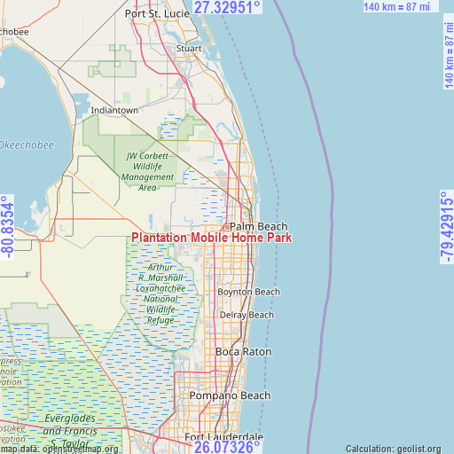
| Upper-left | 27.32951°, | -80.8354° |
| Center: | 26.70312°, | -80.13227° |
| Lower-right: | 26.07326°, | -79.42915° |
| Map W x H: | 139.7×139.7 km | = 86.8×86.8mi |
| max Lat: | 71.29058° ⇑97.8% North |
| Plantation Mobile Home Park: | 26.70312° |
| min Lat: | ⇓2.2% South 19.06759° |
| min Long | Plantation Mobi | max Long |
| -171.73463° | -80.13227° | -66.98998° |
| W 72.6%⇐ | ⇒27.4% E |
Elevation
Elevation of Plantation Mobile Home Park is 11 m = 36 ft, and this is 283.8 m = 931 ft below average elevation for this country.
| Max E: |
3189 m = 10463 ft | 93% |
| Avg. | 294.8 m = 967 ft | |
| Plantation Mobile Home Park | 11 m = 36 ft | |
Min E: |
-60 m = -197 ft | 7% |
See also: United States elevation on elevation.city.
Geographical zone
Plantation Mobile Home Park is located in North temperate zone (between Tropic of Cancer and the Arctic Circle). Distance of this Northern Tropic circle is 363.2 km =225.7 mi to South.| Distance of | km | miles | from Plantation Mobile Home Park |
|---|---|---|---|
| North Pole | 7038 | 4373.2 | to North |
| Arctic Circle | 4432.1 | 2754 | to North |
| Tropic Cancer | 363.2 | 225.7 | to South |
| Equator | 2969.1 | 1844.9 | to South |


Nearby cities:
15 places around Plantation Mobile Home Park: (largest is in red/bold)
• Greenacres City
8.9 km =5.5 mi,  175°
175°
• Gun Club Estates
4 km =2.5 mi,  141°
141°
• Haverhill
1.8 km =1.1 mi, 137°
• Lake Belvedere Estates
1.5 km =0.9 mi, 184°
• Lake Clarke Shores
8.5 km =5.3 mi, 138°
• Lake Worth Corridor
10.1 km =6.3 mi,  162°
162°
• Mangonia Park
8.6 km =5.3 mi,  42°
42°
• Palm Beach
9.5 km =5.9 mi,  88°
88°
• Palm Springs
8.3 km =5.2 mi,  154°
154°
• Royal Palm Beach
9.8 km =6.1 mi,  273°
273°
• Royal Palm Estates
2.5 km =1.6 mi, 163°
• Schall Circle
2.2 km =1.4 mi,  50°
50°
• Stacey Street
1 km =0.6 mi,  121°
121°
• West Gate
3.4 km =2.1 mi, 91°
• West Palm Beach
8 km =5 mi,  80°
80°
Sources, notices
• [Note1] Compared only with cities in United States existing in our database
• [Src1] Map data: © OpenStreetMap contributors (CC-BY-SA)
• [Src2] Other city data from geonames.org with taken over terms of usage.
• [Src3] Geographical zone / Annual Mean Temperature by Robert A. Rohde @ Wikipedia
