Sarasota geodata
Sarasota (Florida) is a seat of a second-order administrative division; located in United States in America/New_York (GMT-4) time zone. With population of 55,118 people, there are 839 cities with bigger population in this country. Compared to other cities in United States, 97.4% of cities are located further ↑North; 63.6% of cities are located further ←West and 93% of cities have higher elevation than Sarasota. Note1


Sarasota GPS coordinates[2]
27° 20' 11.148" North, 82° 31' 50.34" West
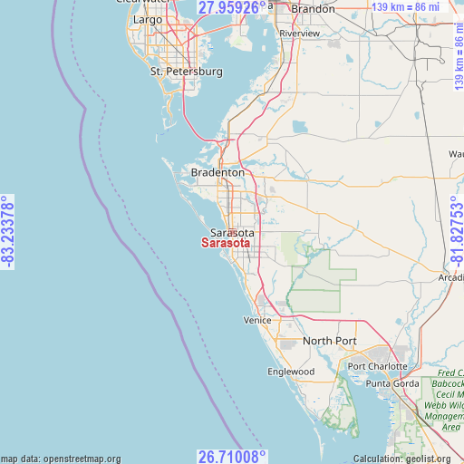
| Map corner | latitude | longitude |
|---|---|---|
| Upper-left | 27.95926°, | -83.23378° |
| Center: | 27.33643°, | -82.53065° |
| Lower-right: | 26.71008°, | -81.82753° |
| Map W x H: | 138.9×138.9 km | = 86.3×86.3mi |
| max Lat: | 71.29058° ⇑97.4% North |
| Sarasota: | 27.33643° |
| min Lat: | ⇓2.6% South 19.06759° |
| min Long | Sarasota | max Long |
| -171.73463° | -82.53065° | -66.98998° |
| W 63.6%⇐ | ⇒36.4% E |
Elevation
Elevation of Sarasota is 11 m = 36 ft, and this is 283.8 m = 931 ft below average elevation for this country.
| Max E: |
3189 m = 10463 ft | 93% |
| Avg. | 294.8 m = 967 ft | |
| Sarasota | 11 m = 36 ft | |
Min E: |
-60 m = -197 ft | 7% |
See also: Sarasota elevation on elevation.city.
Geographical zone
Sarasota is located in North temperate zone (between Tropic of Cancer and the Arctic Circle). Distance of this Northern Tropic circle is 433.6 km =269.4 mi to South.| Distance of | km | miles | from Sarasota |
|---|---|---|---|
| North Pole | 6967.5 | 4329.4 | to North |
| Arctic Circle | 4361.6 | 2710.2 | to North |
| Tropic Cancer | 433.6 | 269.4 | to South |
| Equator | 3039.5 | 1888.7 | to South |


Nearby cities:
15 places around Sarasota: (largest is in red/bold)
• Bee Ridge
7.6 km =4.7 mi,  139°
139°
• Desoto Lakes
5.6 km =3.5 mi,  46°
46°
• Fruitville
7.3 km =4.5 mi,  95°
95°
• Gulf Gate Estates
9.5 km =5.9 mi,  170°
170°
• Kensington Park
4.2 km =2.6 mi, 52°
• Lake Sarasota
10.4 km =6.5 mi,  117°
117°
• North Sarasota
4.3 km =2.7 mi,  16°
16°
• Ridge Wood Heights
5.7 km =3.5 mi,  162°
162°
• Sarasota Springs
5.9 km =3.7 mi, 121°
• Siesta Key
7.8 km =4.8 mi,  190°
190°
• South Gate Ridge
6.5 km =4 mi,  148°
148°
• South Sarasota
5.6 km =3.5 mi,  182°
182°
• Southgate
3.8 km =2.4 mi, 146°
• The Meadows
6.7 km =4.2 mi,  65°
65°
• Whitfield
9.1 km =5.7 mi,  337°
337°
Sources, notices
• [Note1] Compared only with cities in United States existing in our database
• [Src1] Map data: © OpenStreetMap contributors (CC-BY-SA)
• [Src2] Other city data from geonames.org with taken over terms of usage.
• [Src3] Geographical zone / Annual Mean Temperature by Robert A. Rohde @ Wikipedia
