Steinhatchee geodata
Steinhatchee (Florida) is a populated place; located in United States in America/New_York (GMT-4) time zone. With population of 1,047 people, there are 15982 cities with bigger population in this country. Compared to other cities in United States, 94.2% of cities are located further ↑North; 60.9% of cities are located further ←West and 95.7% of cities have higher elevation than Steinhatchee. Note1


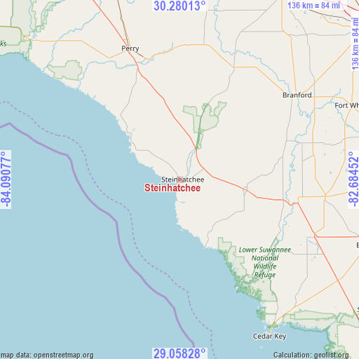
Steinhatchee GPS coordinates[2]
29° 40' 15.816" North, 83° 23' 15.504" West
| Map corner | latitude | longitude |
|---|---|---|
| Upper-left | 30.28013°, | -84.09077° |
| Center: | 29.67106°, | -83.38764° |
| Lower-right: | 29.05828°, | -82.68452° |
| Map W x H: | 135.9×135.9 km | = 84.4×84.4mi |
| max Lat: | 71.29058° ⇑94.2% North |
| Steinhatchee: | 29.67106° |
| min Lat: | ⇓5.8% South 19.06759° |
| min Long | Steinhatchee | max Long |
| -171.73463° | -83.38764° | -66.98998° |
| W 60.9%⇐ | ⇒39.1% E |
Elevation
Elevation of Steinhatchee is 8 m = 26 ft, and this is 286.8 m = 941 ft below average elevation for this country.
| Max E: |
3189 m = 10463 ft | 95.7% |
| Avg. | 294.8 m = 967 ft | |
| Steinhatchee | 8 m = 26 ft | |
Min E: |
-60 m = -197 ft | 4.3% |
See also: United States elevation on elevation.city.
Geographical zone
Steinhatchee is located in North temperate zone (between Tropic of Cancer and the Arctic Circle). Distance of this Northern Tropic circle is 693.2 km =430.7 mi to South.| Distance of | km | miles | from Steinhatchee |
|---|---|---|---|
| North Pole | 6707.9 | 4168.1 | to North |
| Arctic Circle | 4102.1 | 2548.9 | to North |
| Tropic Cancer | 693.2 | 430.7 | to South |
| Equator | 3299.1 | 2050 | to South |


Nearby cities:
15 places around Steinhatchee: (largest is in red/bold)
• Andrews
51.3 km =31.9 mi,  107°
107°
• Branford
54.7 km =34 mi,  54°
54°
• Bronson
76.2 km =47.3 mi, 109°
• Cedar Key
68.3 km =42.4 mi,  150°
150°
• Chiefland
55.5 km =34.5 mi, 113°
• Cross City
25.5 km =15.8 mi,  99°
99°
• Fanning Springs
45.2 km =28.1 mi, 101°
• Fort White
70.8 km =44 mi,  66°
66°
• High Springs
78.3 km =48.7 mi,  77°
77°
• Live Oak
79.5 km =49.4 mi,  29°
29°
• Manatee Road
49 km =30.4 mi, 111°
• Mayo
47.2 km =29.3 mi, 25°
• Newberry
75.5 km =46.9 mi,  92°
92°
• Perry
53.1 km =33 mi,  339°
339°
• Trenton
55.5 km =34.5 mi, 96°
Sources, notices
• [Note1] Compared only with cities in United States existing in our database
• [Src1] Map data: © OpenStreetMap contributors (CC-BY-SA)
• [Src2] Other city data from geonames.org with taken over terms of usage.
• [Src3] Geographical zone / Annual Mean Temperature by Robert A. Rohde @ Wikipedia
