Fillmore geodata
Fillmore (Indiana) is a populated place; located in United States in America/Indiana/Indianapolis (GMT-4) time zone. With population of 526 people, there are 20560 cities with bigger population in this country. Compared to other cities in United States, 50.5% of cities are located further ↓South; 50.9% of cities are located further ←West and 64.1% of cities have lower elevation than Fillmore. Note1


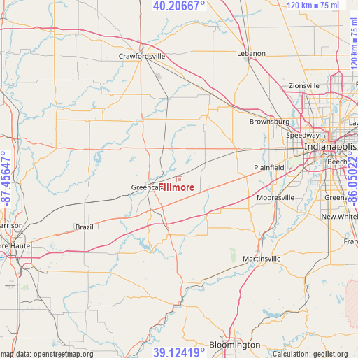
Fillmore GPS coordinates[2]
39° 40' 3.18" North, 86° 45' 12.024" West
| Map corner | latitude | longitude |
|---|---|---|
| Upper-left | 40.20667°, | -87.45647° |
| Center: | 39.66755°, | -86.75334° |
| Lower-right: | 39.12419°, | -86.05022° |
| Map W x H: | 120.4×120.4 km | = 74.8×74.8mi |
| max Lat: | 71.29058° ⇑49.5% North |
| Fillmore: | 39.66755° |
| min Lat: | ⇓50.5% South 19.06759° |
| min Long | Fillmore | max Long |
| -171.73463° | -86.75334° | -66.98998° |
| W 50.9%⇐ | ⇒49.1% E |
Elevation
Elevation of Fillmore is 258 m = 846 ft, and this is 36.8 m = 121 ft below average elevation for this country.
| Max E: |
3189 m = 10463 ft | 35.9% |
| Avg. | 294.8 m = 967 ft | |
| Fillmore | 258 m = 846 ft | |
Min E: |
-60 m = -197 ft | 64.1% |
See also: United States elevation on elevation.city.
Geographical zone
Fillmore is located in North temperate zone (between Tropic of Cancer and the Arctic Circle). Distance of this Northern Tropic circle is 1804.7 km =1121.4 mi to South.| Distance of | km | miles | from Fillmore |
|---|---|---|---|
| North Pole | 5596.4 | 3477.4 | to North |
| Arctic Circle | 2990.6 | 1858.3 | to North |
| Tropic Cancer | 1804.7 | 1121.4 | to South |
| Equator | 4410.6 | 2740.6 | to South |


Nearby cities:
15 places around Fillmore: (largest is in red/bold)
• Avon
32 km =19.9 mi,  70°
70°
• Bainbridge
11.6 km =7.2 mi,  334°
334°
• Clayton
19.9 km =12.4 mi,  83°
83°
• Cloverdale
17.3 km =10.7 mi,  191°
191°
• Coatesville
7.5 km =4.7 mi, 72°
• Danville
22 km =13.7 mi,  61°
61°
• Greencastle
9.9 km =6.2 mi,  254°
254°
• Heritage Lake
7.6 km =4.7 mi,  28°
28°
• Jamestown
30.7 km =19.1 mi,  20°
20°
• Ladoga
27.7 km =17.2 mi,  351°
351°
• Monrovia
25.2 km =15.7 mi,  112°
112°
• North Salem
23.4 km =14.5 mi, 23°
• Pittsboro
32.8 km =20.4 mi,  48°
48°
• Plainfield
30.6 km =19 mi, 82°
• Roachdale
20.6 km =12.8 mi, 348°
Sources, notices
• [Note1] Compared only with cities in United States existing in our database
• [Src1] Map data: © OpenStreetMap contributors (CC-BY-SA)
• [Src2] Other city data from geonames.org with taken over terms of usage.
• [Src3] Geographical zone / Annual Mean Temperature by Robert A. Rohde @ Wikipedia
