Douglass Hills geodata
Douglass Hills (Kentucky) is a populated place; located in United States in America/Kentucky/Louisville (GMT-4) time zone. With population of 5,669 people, there are 6632 cities with bigger population in this country. Compared to other cities in United States, 60.4% of cities are located further ↑North; 54.4% of cities are located further ←West and 55.1% of cities have lower elevation than Douglass Hills. Note1


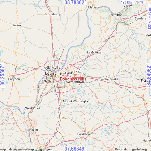
Douglass Hills GPS coordinates[2]
38° 14' 16.26" North, 85° 33' 9.864" West
| Map corner | latitude | longitude |
|---|---|---|
| Upper-left | 38.78802°, | -86.25587° |
| Center: | 38.23785°, | -85.55274° |
| Lower-right: | 37.68349°, | -84.84962° |
| Map W x H: | 122.8×122.8 km | = 76.3×76.3mi |
| max Lat: | 71.29058° ⇑60.4% North |
| Douglass Hills: | 38.23785° |
| min Lat: | ⇓39.6% South 19.06759° |
| min Long | Douglass Hills | max Long |
| -171.73463° | -85.55274° | -66.98998° |
| W 54.4%⇐ | ⇒45.6% E |
Elevation
Elevation of Douglass Hills is 219 m = 719 ft, and this is 75.8 m = 249 ft below average elevation for this country.
| Max E: |
3189 m = 10463 ft | 44.9% |
| Avg. | 294.8 m = 967 ft | |
| Douglass Hills | 219 m = 719 ft | |
Min E: |
-60 m = -197 ft | 55.1% |
See also: United States elevation on elevation.city.
Geographical zone
Douglass Hills is located in North temperate zone (between Tropic of Cancer and the Arctic Circle). Distance of this Northern Tropic circle is 1645.7 km =1022.6 mi to South.| Distance of | km | miles | from Douglass Hills |
|---|---|---|---|
| North Pole | 5755.4 | 3576.2 | to North |
| Arctic Circle | 3149.5 | 1957 | to North |
| Tropic Cancer | 1645.7 | 1022.6 | to South |
| Equator | 4251.7 | 2641.9 | to South |


Nearby cities:
15 places around Douglass Hills: (largest is in red/bold)
• Anchorage
3.6 km =2.2 mi,  28°
28°
• Bellemeade
3.8 km =2.4 mi,  294°
294°
• Blue Ridge Manor
1.1 km =0.7 mi,  303°
303°
• Houston Acres
5.9 km =3.7 mi,  243°
243°
• Hurstbourne
3.1 km =1.9 mi,  270°
270°
• Hurstbourne Acres
3.7 km =2.3 mi, 239°
• Jeffersontown
5 km =3.1 mi,  191°
191°
• Lyndon
4.8 km =3 mi, 296°
• Meadow Vale
5.3 km =3.3 mi,  341°
341°
• Middletown
1.5 km =0.9 mi,  55°
55°
• Plantation
6.1 km =3.8 mi,  326°
326°
• Rolling Hills
5.3 km =3.3 mi, 339°
• Saint Regis Park
5.7 km =3.5 mi,  257°
257°
• Westwood
5.4 km =3.4 mi, 330°
• Woodland Hills
2.5 km =1.6 mi,  83°
83°
Sources, notices
• [Note1] Compared only with cities in United States existing in our database
• [Src1] Map data: © OpenStreetMap contributors (CC-BY-SA)
• [Src2] Other city data from geonames.org with taken over terms of usage.
• [Src3] Geographical zone / Annual Mean Temperature by Robert A. Rohde @ Wikipedia
